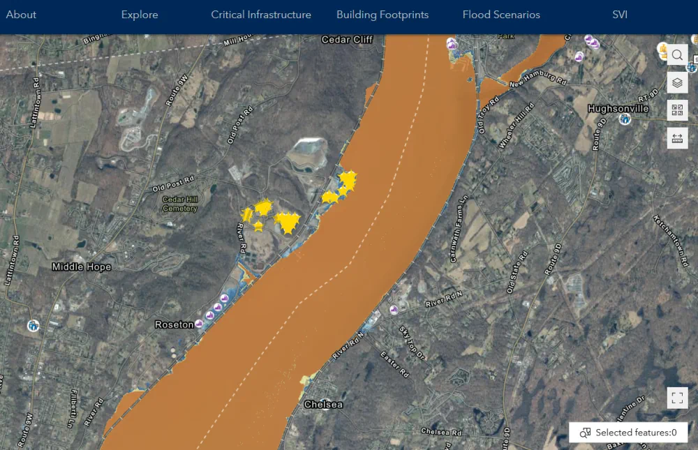
An accessible new mapping tool will make it easier for individuals and communities to plan for flooding and sea level rise. Developed by the NASA Socioeconomic Data and Applications Center (SEDAC) at Columbia Climate School’s CIESIN, the mapper visualizes spatial data for infrastructure across nearly all of New York State, except New York City. The New York Flood Impact Support System Application (NYS FIDSS) is unique because it contains digitized data for every building footprint in the included areas. It is highly interactive and accessible, ensuring that historically underrepresented communities can create comprehensive flood scenarios for planning, response, and policy making. The Mapper includes a data set based on the Centers for Disease Control’s Social Vulnerability Index, allowing users to visualize social vulnerability for areas impacted by flooding.