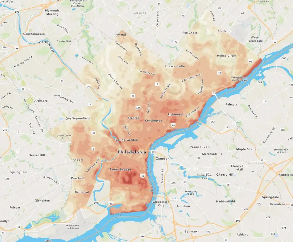
As Philadelphia plants thousands of trees to help cool heat-stricken sections of the city, residents can use a new online tool to see how the decade-long project might help their neighborhoods. You can slide between two overlapping maps of the city: one that reveals how bad the summer heat problem is on a detailed, block-by-block basis, and another that shows which areas are prioritized for tree-planting.
There’s also a standalone map with detailed info showing how temperature islands shift throughout the day. The western part of Washington Avenue in Point Breeze, for example, is one of the city’s hottest places in the city in mornings and evenings, but other areas get hotter midday. The maps are part of a new website developed by the Nature Conservancy’s Pennsylvania staff, which describes how citizen-scientists collected heat readings around the city last summer and what they found.
“Policymakers can use this now to more easily look at how it can inform decisions they’re making around cooling efforts in the city, and use it as an advocacy tool to drive investment where it’s needed the most,” said Johnson, who previously worked on the heat mapping effort at the Academy of Natural Sciences.