Have you ever wondered who provides your sewer services, when your street is scheduled to be swept, what average daily traffic volumes are on streets near you or when the sidewalk in front of your house was last replaced? Menlo Park residents can now find the answer to these questions and more on Menlo Park’s new GIS Hub. The new website, which was launched in early June, serves as a repository of public GIS data for the city of Menlo Park.
Patrick Palmer, a GIS analyst, and Whit Loy, Menlo Park’s enterprise application manager, started creating the Menlo Park GIS Hub about a year and a half ago, after being inspired by other public data portals that they saw at a GIS conference.
“One of the driving factors for creating the hub was the need to fill a request for data. There’s this constant need for more information from our residents and regionally,” Loy said.
Though the data already existed and many of the maps and applications had previously been created, they were often hard to find as they were scattered throughout various project-specific city web pages. With this public hub, Loy and Palmer hope to create easier, more equitable access to public city data.
“We wanted to take all of the cool GIS stuff and centralize it,” said Palmer. “A big part of this has been having our open data portal be part of the website. It’s more equitable, anyone with an internet connection can access the data. If we have something online and you’re interested in it, go for it. We implore you to use it.”
Both Loy and Palmer waxed poetic about the immense utility of GIS data for residents, researchers and everyone in between.
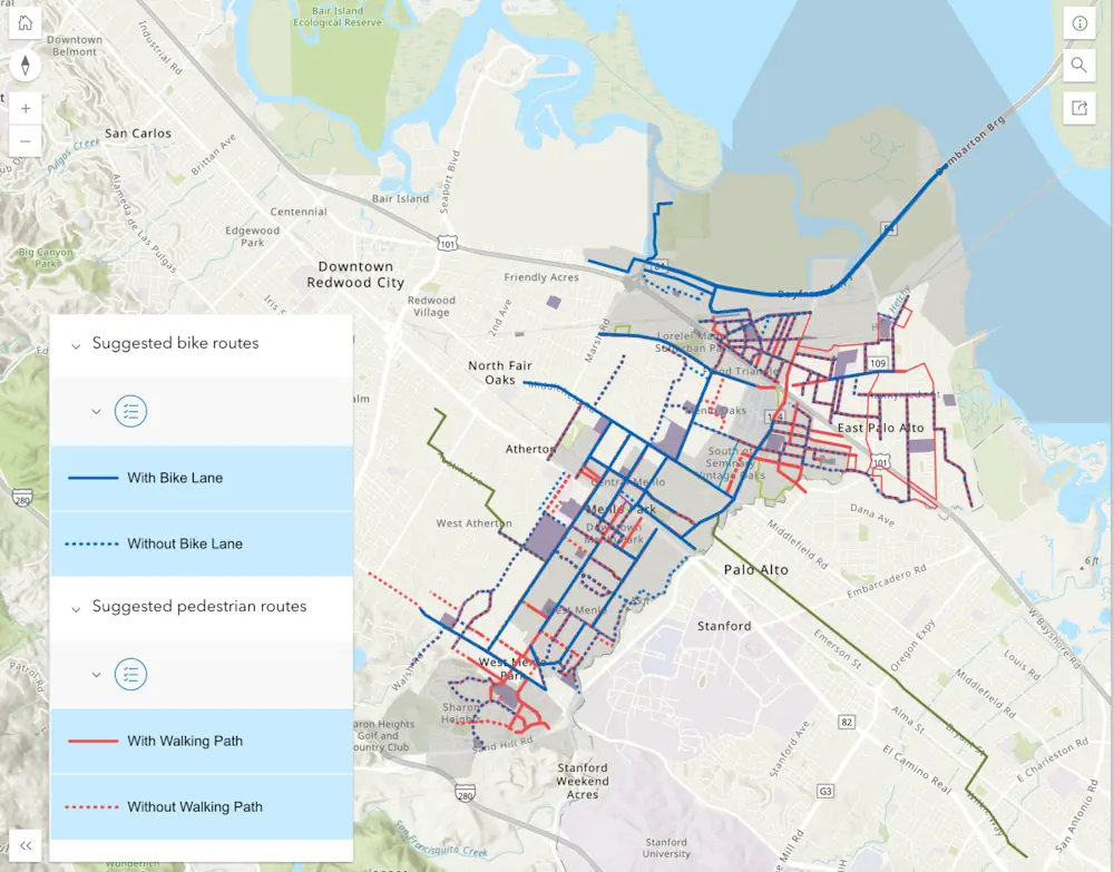
“GIS has this preconceived notion of it being a map, but it’s really more of a spatial intelligence tool that allows us to make better decisions based on data,” said Loy. “People are thinking, ‘how can I use this public data of what’s around me to help make better decisions in our daily lives? How are my kids going to bike to school? What’s the safest route for them?,’ etcetera.”
Palmer said that several student research groups from University of California at Berkeley, Stanford University and even the Boy Scouts have requested GIS data from the city to help with housing studies, entrepreneurial ideas and Eagle Scout projects.
Menlo Park residents and visitors can also access and contribute to the city’s public GIS data through an application called ACT Menlo Park. This application helps Menlo Park residents report non-emergency issues such as potholes, broken street signs, traffic enforcement issues or tree issues to city staff.
The application uses GIS technology to track these issues. Users can even see maps of reported and resolved issues within the city. Data about the locations of recurring issues can even help the city make long range planning decisions.
“The system will track over time the condition of a street versus the cost of replacement and hopefully try to guide us to make better decisions,” said Loy. “You can see you’ve spent this amount of money to fix X amount of potholes, so there might be a larger issue with the street. You might want to look at repaving it.”
Palmer said that the ongoing data that the city gains from GIS technology also helps the city write more efficient work orders.
“You can tell if a sign has been up in the field, maybe for like five years, it might be getting kind of faded. And without even having to go out of the office, you could be like, alright, it could be time to make a replacement on that,” he said.
Beyond the public GIS Hub and ACT Menlo Park app, Menlo Park uses GIS to support a wide variety of city operations. The city, like many other municipalities in the Bay Area, uses GIS technology to help analyze patterns and make informed decisions on spatially related problems, such as urban planning, emergency management, environmental management, transportation planning, tax records and other public services.
Several big projects, which will be heavily supported by GIS technology, are coming up in the future for Menlo Park.
As part of the city’s Vision Zero action plan to prevent traffic deaths and injuries in the city, Menlo Park will be creating a Vision Zero dashboard to track upgrades to street safety, and using other GIS data to track car crash locations and statistics.
Vision Zero will look at the granular data collected from each crash incident to help design safer streets.
“They’re not just looking at the like, where was the crash, but at what happened,” said Loy. “And what was the outcome? They’re looking many levels deep in order, again, to make policy decisions and funding decisions.”
Menlo Park staff plan to continue expanding the amount of data that is available to the public.