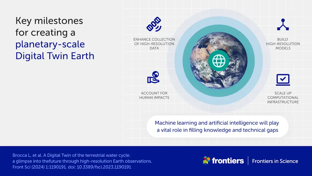
The water cycle looks simple in theory—but human impacts, climate change, and complicated geography mean that in practice, floods and droughts remain hard to predict. To model water on Earth, you need incredibly high-resolution data across an immense expanse, and you need modeling sophisticated enough to account for everything from snowcaps on mountains to soil moisture in valleys. Now, scientists have made a tremendous step forward by building the most detailed models created to date.
“Simulating the Earth at high resolution is very complex, and so basically the idea is to first focus on a specific target,” said Dr. Luca Brocca of the National Research Council of Italy, lead author of the article published in Frontiers in Science. “That’s the idea behind what we have developed—digital twin case studies for the terrestrial water cycle in the Mediterranean Basin. Our goal is to create a system that allows non-experts, including decision-makers and citizens, to run interactive simulations.“
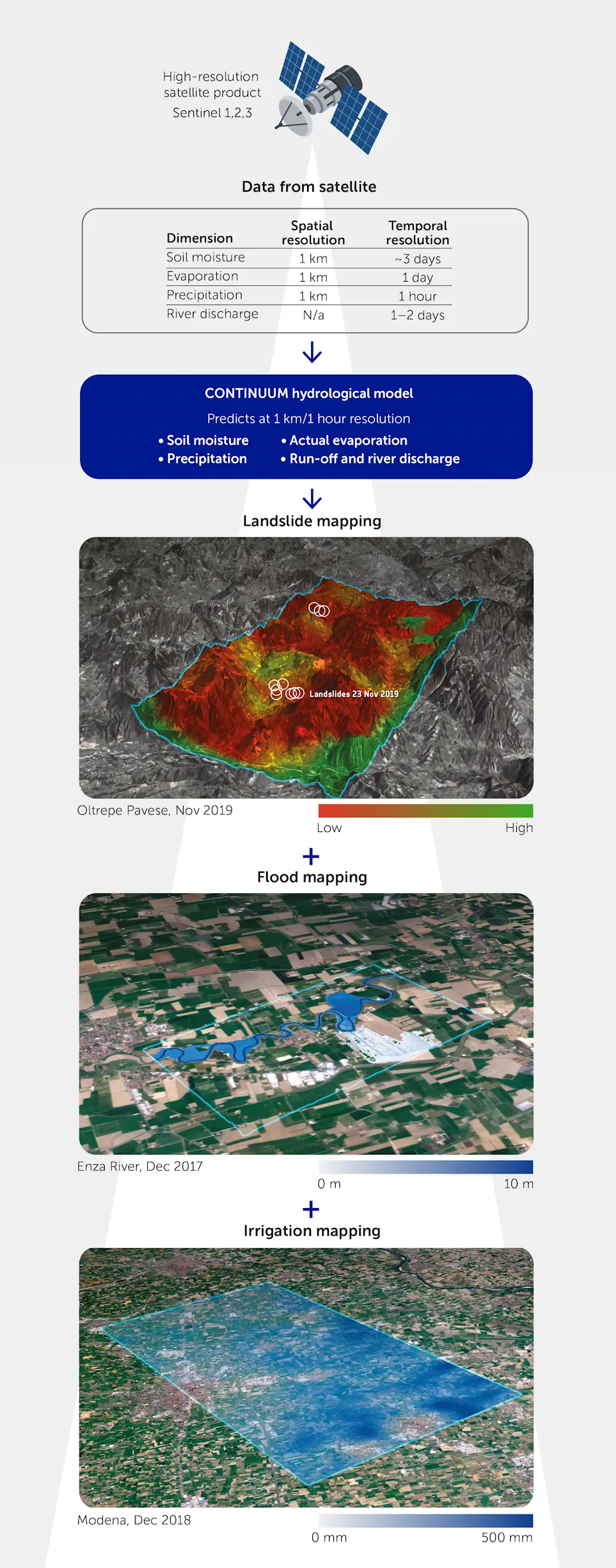
To build their digital twin models, Brocca and his colleagues harnessed extraordinary volumes of satellite data, combining new Earth observation data that measures soil moisture, precipitation, evaporation, river discharge, and snow depth. This newly available data, crucial to the development of the models, includes measurements taken much more frequently across space and time: as often as once a kilometer and once an hour.
Like a screen with more pixels, this higher-resolution data creates a more detailed picture. The scientists used this data to develop their modeling, and then integrated the modeling into a cloud-based platform which can be used for simulations and visualizations. This is the ultimate goal: an interactive tool anyone can use to map risks like floods and landslides and manage water resources.
The scientists began by modeling the Po River valley, then expanded the digital twin to other parts of the Mediterranean basin. Upcoming projects plan to expand to cover all of Europe, and future collaborations will allow the same principles to be applied around the world.