The best known use of GPS satellites is to help people know their location whether driving a car, navigating a ship or plane, or trekking across remote territory. Another important, but lesser-known, use is to distribute information to other Earth-viewing satellites to help them pinpoint measurements of our planet. NASA and several other federal agencies, including the U.S. Space Force, U.S. Space Command, the U.S. Naval Research Laboratory, and the National Geospatial-Intelligence Agency are improving the location accuracy of these measurements down to the millimeter with a new set of laser retroreflector arrays, or LRAs.
“The primary benefit of laser ranging and LRAs is to improve the geolocation of all of our Earth observations,” said Stephen Merkowitz, project manager for NASA’s Space Geodesy Project at NASA’s Goddard Space Flight Center in Greenbelt, Maryland.
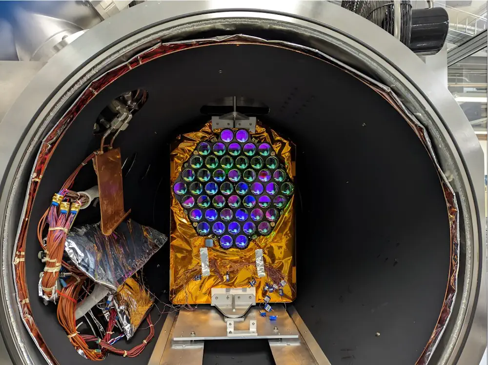
A team of scientists and engineers with the project tested these arrays earlier this year to ensure they were up to their task and they could withstand the harsh environment of space. Recently the first set of these new laser retroreflector arrays was shipped to the U.S. Space Force and Lockheed Martin in Littleton, Colorado, to be added to the next generation of GPS satellites.
Laser ranging and laser retroreflector arrays have been part of space missions for decades, and they are currently mounted on and essential to the operation of Earth-viewing satellites like ICESat-2 (Ice, Cloud, and land Elevation satellite 2), SWOT (Surface Water and Ocean Topography), and GRACE-FO (Gravity Recovery and Climate Experiment Follow On). LRAs for laser ranging were even deployed on the surface of the moon during the Apollo missions.
For laser ranging, scientists want to direct light beams back to the original source. They do this by placing three mirrors at right angles, essentially forming an inside corner of a cube. The laser retroreflector arrays are made up of an array of 48 of these mirrored corners.