For many Hawaiian farmers, agriculture is more than a profession; it is their kuleana, or responsibility. It is a practice with deep cultural roots tied to the ancient concept of aloha ʻāina—love and responsible stewardship of the land. Despite this cultural connection to farming, agricultural production and food systems across Hawai’i have suffered from decades of commercial exploitation, climate change, economic volatility and policy failures. Historically, Hawai’i allocates less than 1% of the state budget to agriculture.
At first glance, NASA may seem like an unlikely partner in bolstering traditional farming practices. Their medium is data, not dirt; their tools are computers, not the body; they are driven by innovation rather than tradition. But in Maui County, which reports the state’s highest prevalence of food insecurity, these extremes are meeting in the middle to repair parts of the food system in a sustainable and culturally appropriate way.
A dependence on mainland agricultural imports has led to supply chain vulnerabilities, high food prices and increased food insecurity, especially among low-income residents, Native Hawaiians and Pacific Islanders, who disproportionately face higher rates of food insecurity. Hawai’i has made agricultural self-sufficiency a priority, and has embarked on a concentrated effort to increase local food production. To help, researchers from NASA Harvest, an agency consortium focused on food security and environmental resiliency, have used satellite imagery to help drive decisions about the best ways to expand agricultural production and efficiency.
Hannah Kerner—an assistant professor at Arizona State University and the AI and Machine Learning Lead for NASA Harvest and NASA Acres—was awarded a research grant in 2021 through NASA’s equity and environmental justice initiative to assist Maui County in increasing local food production. Kerner’s objective is to create a data dashboard using satellite imagery and artificial intelligence fed by on-the-ground data. This information will allow farmers, community leaders and policymakers to monitor and analyze crop conditions across Maui County and address food insecurity based on real-time data, filling a long-term knowledge gap that government agricultural surveys have not adequately addressed. “There’s a need at the basic level to be able to monitor how much food and where food is being grown in the county,” Kerner said. To achieve this, Kerner’s team created crop-type maps, or high-resolution spatial maps specific to each crop type.
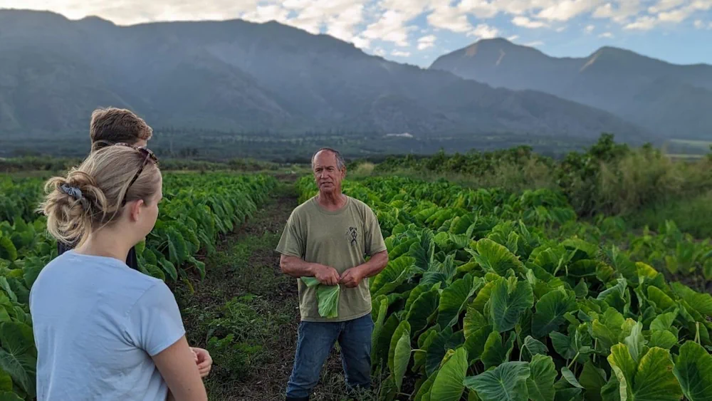
The first crop type map Kerner’s team created for Maui farmers tracks the growth of taro — a nutrient-dense and culturally venerated staple crop. The dashboard has also been used beyond just agriculture. Following the August 2023 wildfires, NASA mapped out burned areas to help community organizers distribute aid as quickly as possible. The tool allowed the Maui United Way to distribute $7.5 million in disaster relief to impacted residents within just two months of the Lahaina fire, according to Winfrey.