Africa’s forested areas—an estimated 14 % of the global forest area—are continuing to decline at an increasing rate—mostly because of human activities to convert forest land for economic purposes. As natural forests are important CO2 and biodiversity reservoirs, this development has a significant impact on climate change and affects the integrity of nature. To intervene in a targeted manner in the interests of climate protection and biodiversity, there has been a lack of sufficiently good data and detailed knowledge of the various forms of subsequent utilization of deforested areas to track where forest-related conversions are happening and why.
This has now been provided by a new study published in the journal Scientific Reports and led by Robert N. Masolele and Johannes Reiche from Wageningen University in the Netherlands, Martin Herold from the GFZ German Research Center for Geosciences in Potsdam, and their team.
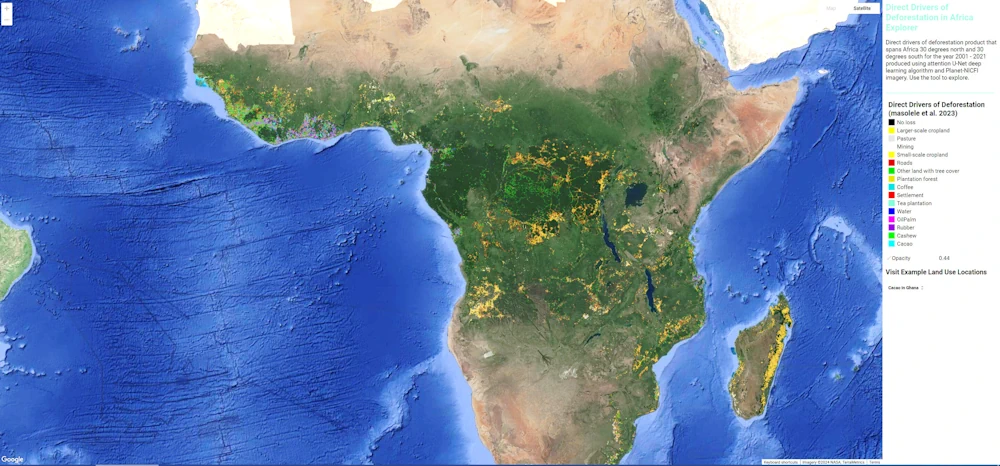
They used high-resolution satellite data, which they analyzed on the basis of local reference data for 15 different types of land use—from crops such as coffee, cashew, and rubber to pastureland and mining—with the help of deep learning methods. This enabled them to create the first high-resolution (accurate to five meters) and continental mapping of land use after deforestation across a wide area of the African continent, including wet and dry forests.