An ambitious project launched in 2021, Madatlas aims to build an LMD training program in digital cartography at the University of Fianarantsoa. With the aim of enabling the Malagasy people to play an active role in the creation of a digital atlas of the island, Madatlas has given rise to training, research and partnerships between the Gustave Eiffel University research team and a host of local players.
“At the origin of this project was the desire to create an online atlas of Madagascar. A digital tool, fed and updated over time”, recalls Sophie Moreau, geographer and coordinator of the Madatlas project, run by the Université Gustave Eiffel and the Université de Fianarantsoa, in partnership with the Institut de Recherche pour le Développement and the Université Bordeaux Montaigne.
From the very outset of this project, to be launched in 2021, the atlas has become the backbone of a broader international cooperation in which the worlds of academia, research, training, business and public institutions continually intersect and enrich each other.
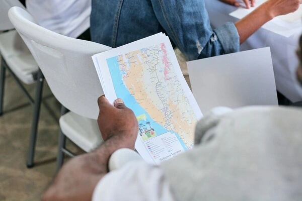
Mapping Madagascar? The stakes are high, as cartography is today an essential tool for land planning and development. And digital cartography means collecting and processing data using appropriate IT tools, to create dynamic, up-to-date maps. Drinking water networks, road maintenance, drought- and fire-prone areas, floods and natural disasters, social and gender inequalities… Cartography is fed by a wide range of data, enabling French and Madagascan researchers to propose relevant analysis and decision-making tools in all these areas of Madagascar’s sustainable development.
It soon became clear to the Madatlas team: “One way of producing maps was to strengthen the training of Madagascan players – students, teachers, researchers and professionals – in all stages of the cartographic process”, explains Sophie Moreau.
Andry Razakamanantsoa, a member of Madatlas and deputy director of the Geomaterials, Environmental Interactions (GIE) laboratory at the Université Gustave Eiffel, confirms: “Our ambition is to ensure the sustainability of the work carried out, so that the project continues even if we’re no longer here. As researchers, we’re taking advantage of this opportunity to set up structures that are sustainable and compatible with the reality of the country, without necessarily being modelled on what we have in France.“
In addition to the development of an equity and gender charter as part of the project’s funding by the Agence Française pour le Développement, a research component and another devoted to links with professionals, the heart of the Madatlas project is training. The establishment of a LMD (Licence-Master-Doctorat) program and professional training courses, as well as support for a dozen PhD students, are all aimed at turning today’s Madagascan students and professionals into tomorrow’s cartographers. Partnerships with local companies and public institutions are also encouraged, to promote the employment of young researchers while strengthening the links between those involved in Madagascan development.
It was in this spirit that the first Madatlas summer university was held from April 22 to 30 at the University of Fianarantsoa. The week of work and exchanges between Madagascan and French professionals, doctoral students and researchers also saw the first general meeting of collaborative cartography with “State of the Map Madagascar” via the Open Street Map (OSM) mapping tool. A way of highlighting the work carried out by Malagasy people, who are already involved in mapping their island through OSM.
For researchers at the Université Gustave Eiffel, as well as for its administrative staff and their Madagascan counterparts, the pleasant surprise of Madatlas is the reciprocal learning process. “I’m a geographer, but I work for Madatlas with computer scientists, anthropologists, engineers… And even if it’s not always easy to coordinate the work of several laboratories with different habits, it’s really exciting!”
As Andry Razakamanantsoa points out, “It’s not always easy to adapt our European practices to the realities of the field, and to our socio-cultural habits on both sides”. But motivation and the desire to move forward together have enabled the Madatlas team to overcome these difficulties, with one objective: to provide Madagascar with an atlas and a network of scientists and professionals who will build it.