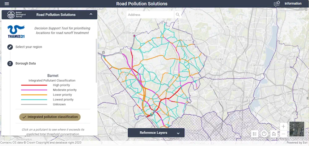
A new online map has been created to show where contaminated rain water from roads is polluting rivers in London. Environmental charity Thames21 has launched the site to help local authorities, as well as local communities, identify problem areas. Thames21 said contaminated run-off was caused by oil spills and tyre wear on the roads which was then washed into rivers and streams when it rained. The interactive map, which has been partly funded by the Mayor of London, Transport for London (TfL), and the Environment Agency, highlights more than 280 miles (450km) of London's roads that pose a "high risk of causing road runoff". These roads are categorised as "a priority for treatment". Roads where heavy goods vehicles regularly apply their brakes were some of the worst affected, the map shows.