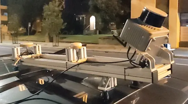
Klau Geomatics has introduced the Brumby RTK Lidar system, an innovative mobile mapping solution equipped with powerful Edge Compute capabilities, enabling the generation of highly precise georeferenced point clouds in real time.
Brumby can be deployed on drones, light aircraft or as a mobile mapping system (MLS). It processes data into a georeferenced point cloud instantly upon capture, eliminating the need for post-processing. This seamless workflow allows for immediate integration into analytics, site assessments, volume measurements and any other required tasks. With Brumby, there’s no data backlog – today’s capture is ready for immediate use, eliminating delays and streamlining workflows.
The Brumby integrates dual-receiver SPAN INS from NovAtel, running NTRIP RTK or Terrastar-C Pro PPP, with custom code to manage coordinate systems and apply precise geoid models to the trajectory. Then, still in real time, the Lidar raw vectors are projected into millions of accurate RTK survey measurements. The Brumby Edge Compute runs chip-level firmware and highly efficient low-level code on custom hardware to achieve this outstanding outcome.