INFOMAR (Integrated Mapping for the Sustainable Development of Ireland’s Marine Resource) has launched the Blue Scale Map Series, a collection of 18 high-resolution bathymetric maps of Ireland’s coastal waters. Developed by a dedicated team of hydrographers, data processors and cartographers, the maps highlight the topography of the coast in unprecedented detail.
Ireland’s coastline is 3,171km in length and boasts some of the most unique & dynamic environments in Europe. This new Blue Scale Map Series is the culmination of over a decade of work and highlights the intricate landscapes that lie beneath the waves. Each map is carefully drawn to include the latest high-resolution INFOMAR bathymetry data.
Starting this week and for the next 18 weeks, INFOMAR will be releasing a new map of a different section of the Irish coastline. As with all INFOMAR data, these high-resolution maps are available for all to download for free. The first in the series is the bluescale bathymetric map of Galway Bay.
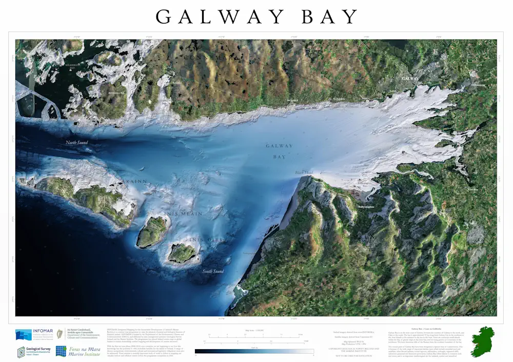
Starting this week and for the next 18 weeks, INFOMAR will be releasing a new map of a different section of the Irish coastline. As with all INFOMAR data, these high-resolution maps are available for all to download for free. The first in the series is the bluescale bathymetric map of Galway Bay.