Wildfire fighting and forest management decisions are potentially being hampered by inaccurate government data that misrepresents forest fuel loads in British Columbia’s Interior, a new study has found. The B.C. government says the provincial wildfire service is working with the study’s lead author and others to close the data gap, which involves “mismatches” between remotely-sensed mapping, forest fuel classifications and observations on the ground.
“These mismatches make it difficult for fire managers to accurately determine expected fire behaviour before an event occurs,” the researchers say in the study published in the peer-reviewed journal Fire Ecology last month. The mismatches may also result in failure to identify at-risk areas that would benefit from work to mitigate the fuel buildup, the paper says.
Lead author Jen Baron says fixing the data will help officials identify and respond to fire-prone areas, though will likely require a “huge lift.“ “The challenge is that we’re trying to use these fuel-type maps to decide where to put fuel treatments,” she says, referring to measures such as prescribed burning, thinning dense forests or burning piles of “slash” following logging.
Baron said improving how experts map various fuel types will help researchers and wildfire officials understand how fuels interact with today’s environmental conditions, and with each other, to influence fire behaviour, Baron says. “What we really need to be able to do is link the fuel conditions, the fire behaviour,” Baron, a sessional lecturer at the department of forest and conservation sciences at the University of B.C., explained. “Things like the rate of spread, the intensity, the flame length — and the weather, so we can understand how they all work together under different scenarios.”
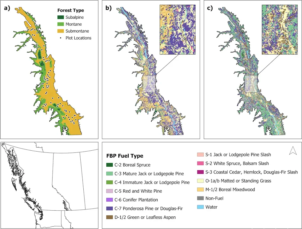
The paper found “poor correspondence” between field observations and government data, specifically B.C.’s vegetation resource index and the national fire behaviour prediction system. The researchers identified 76 plots in an area known as the Rocky Mountain Trench separating the Columbia and Rocky Mountain ranges in southeastern B.C. They found “no suitable match” between national system’s data and field observations in 58 per cent of the one-hectare plots. A further 42 per cent were “partially suitable,” the paper says.
The study also revealed problems with Canada’s fire behaviour prediction system when it comes to classifying fuel types in B.C.’s Interior, Baron says. The existing system uses data from a series of experimental burns 60 years ago, when fire weather and fuel beds were “very different than they are today,” she says. It was also designed primarily to inform fire suppression in boreal forests and uses 16 fuel types to represent conditions throughout Canada, Baron says. “There just really aren’t enough fuel types to represent the diversity of conditions that we have in Interior B.C.“