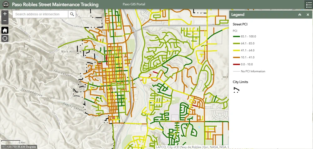
The City of Paso Robles is trying to make it easier for residents to get information about road conditions and future repairs in their neighborhoods. The new interactive street maintenance map application was developed after damage from last year’s storms. Residents now have the opportunity to check a street’s pavement condition index rating, the last maintenance date, or upcoming maintenance information.
Kevin Wells, the assistant capital projects manager with the City of Paso Robles, says a Pavement Condition Index is a way to measure and rate the condition of a road or pavement on a scale from 0 to 100. “We really wanted to be transparent with the residents and everything — with the road conditions,” said Wells. “A pavement condition index is 0 to 100. One-hundred being brand new pavement, brand new base layer. Zero being, obviously, not even road, really.” Wells says each street in the city has been entered into the mapping system with the street’s Pavement Condition Index rating and any recent maintenance records. “We’re going to continuously update it,” said Wells. “There are segments that don’t have history. I think the earliest date I remember is 2007.”