A few years ago, a couple of Google employees reached out to a Minnesota scientist with an unusual proposal: What if they could teach computers to spot beaver habitats from space?
“They wanted to know if I thought it was possible to find beaver wetlands from aerial imagery myself, and then if that could be scaled up with machine learning,” Emily Fairfax, a University of Minnesota beaver researcher and assistant professor of geography, told As It Happens guest host Megan Williams. Fairfax knew that beavers’ sprawling dams were visible on satellite and drone imagery. Scientists have been finding and mapping them that way for years. “The machine learning question really piqued my interest, because the mapping takes a while,” she said. “If we could teach students or researchers to do it, I felt like we could teach a computer to do it. And if anybody knows how to do that, it’s going to be Google.”
Today, Fairfax is heading up a team of engineers, scientists and conservationists who are using the Earth Engine Automated Geospatial Elements Recognition (EEAGER) — as in “eager beaver” — to map the rodents’ infrastructure across California. The project is a joint venture between Google, the conservation group Nature Conservancy and the state of California. If all goes well, their work could pave the way for conservation strategies to boost beaver populations in the state, reduce the impact of flooding and mitigate wildfires.
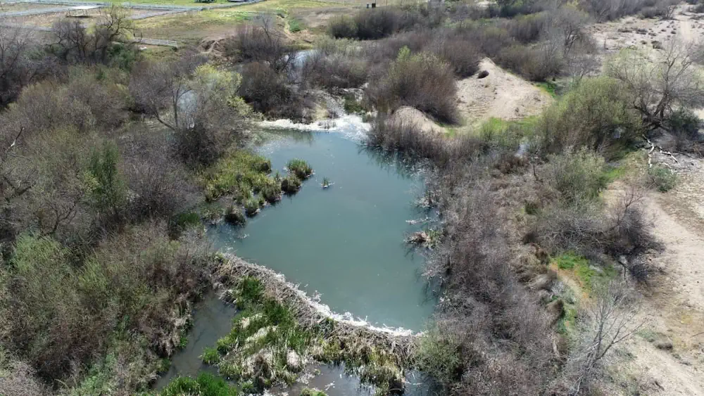
It all started in 2018, when Google tasked one of its mechanical engineers, Eddie Corwin, with helping the company build a corporate water stewardship program. Corwin teamed up with sustainability consultant Dan Ackerstein, and the pair came across Alice Outwater’s book Water: A Natural History. It was there that they learned about the immense ecological importance of the mighty beaver. That’s because beavers are incredible engineers who build dams, ponds and wetlands that store millions of gallons of water. “By storing a bunch of water both on the surface in the ponds, but also underground in the soil, they create these big spongy patches in the landscape that plants are able to access water from when you have a period of drought — and that are, honestly, just too wet to burn when you have a period of fire,” Fairfax said. These structures also reduce erosion and the impacts of flooding, she said. “So as we think about climate change, and you have droughts and floods and fires all intensifying, beavers are kind of helping take all three of those things down a notch,” she said.
As Corwin and Ackerstein were buffing up on beavers, Google was investing heavily in artificial intelligence and machine learning. “Around the same time, there had been articles coming out about the world’s largest beaver dam had been found using Google Earth and satellite imagery … up in Canada,” Corwin said. “I was kind of thinking like, hey, you know, if there is a human out there who’s looking at satellite imagery and finding beaver dams, then it’s going to be possible for a machine to learn how to do that as well.“ Corwin and Ackerstein built a small team of people at Google to work on EEAGER. With the help of Fairfax and other scientists, they taught the algorithm to identify what is — and what isn’t — a beaver dam.
In May 2023, they published a study showing that it worked. Now they’re teaming up with California’s Department of Fish and Wildlife to use EEAGER to map beaver habitats across California. This is important work, Fairfax says, because while scientists have a pretty good idea of what beavers can do, they don’t know how many there are, or where their populations are distributed. With that information, conservationists will be able to tell whether their efforts are working, and identify new locations to reintroduce beavers.