The data set, made available by GNS Science, shows the locations of faults that have broken or deformed the surface in the last 125,000 years.
Scientists made the information available in a bid to help further research, hazard assessment, land-use and emergency planning.
The map marks known faults as red lines which, when combined, streak across much of the country.
GNS Science Senior Paleoseismology Technician Regine Morgenstern, who was the studies lead author, said there was a pressing need to raise awareness of the high-resolution dataset.
"It is expected the dataset will be useful for homeowners, councils, hazard planners, infrastructure managers, geotechnical practitioners and researchers to better understand the potential location of surface fault ruptures during future large earthquakes, at a relevant scale.
"Knowing where New Zealand’s active faults are located can help people make informed decisions about where to build and make existing infrastructure more resilient to the effects of earthquakes.“
While the work marks a major milestone for the dataset, the work is not complete, she said, as faults continue to be mapped in detail.
The interactive map allows users to zoom into any part of New Zealand to survey for active faults.
Extreme levels of detail, such as zooming in on individual buildings, allows for a precise look at where faults run through.
On top of showing active faults, the map has a few other layers: fault sense, recurrence interval, last event, slip rate and single event displacement.
To aid those who may be looking at the map and needing to know which areas fall under different councils authorities, the map also has two layers devoted to territorial authority and regional authority.
The high-resolution data is currently only available for Hawke’s Bay, Manawatū-Whanganui (Horizons), Wellington and Tairāwhiti Gisborne regions as well as the northern Alpine and Wairau faults. More areas will be added as funding permits and work progresses.
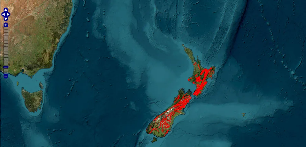
An interactive high-resolution dataset has been released to the public, showing the active faults running through New Zealand.
The data set, made available by GNS Science, shows the locations of faults that have broken or deformed the surface in the last 125,000 years.
Scientists made the information available in a bid to help further research, hazard assessment, land-use and emergency planning.
The map marks known faults as red lines which, when combined, streak across much of the country.
GNS Science Senior Paleoseismology Technician Regine Morgenstern, who was the studies lead author, said there was a pressing need to raise awareness of the high-resolution dataset.
"It is expected the dataset will be useful for homeowners, councils, hazard planners, infrastructure managers, geotechnical practitioners and researchers to better understand the potential location of surface fault ruptures during future large earthquakes, at a relevant scale.
"Knowing where New Zealand’s active faults are located can help people make informed decisions about where to build and make existing infrastructure more resilient to the effects of earthquakes.“
While the work marks a major milestone for the dataset, the work is not complete, she said, as faults continue to be mapped in detail.
The interactive map allows users to zoom into any part of New Zealand to survey for active faults.
Extreme levels of detail, such as zooming in on individual buildings, allows for a precise look at where faults run through.
On top of showing active faults, the map has a few other layers: fault sense, recurrence interval, last event, slip rate and single event displacement.
To aid those who may be looking at the map and needing to know which areas fall under different councils authorities, the map also has two layers devoted to territorial authority and regional authority.
The high-resolution data is currently only available for Hawke’s Bay, Manawatū-Whanganui (Horizons), Wellington and Tairāwhiti Gisborne regions as well as the northern Alpine and Wairau faults. More areas will be added as funding permits and work progresses.