Geomaticians

Fairfax

New Online App Launches To Map Out Public Art Across Fairfax County

ArtsFairfax wants you to help it keep track of all the public art popping up around Fairfax County. The county’s designated, nonprofit local arts agency recently launched an online Public Arts Locator to identify and map out murals, sculptures and other installations placed in the community, either permanently or on a temporary basis. The app ...
ffxnow.com
Geographic Information Systems Help Fire And Rescue Analyze Data In Real-Time

Geographic Information Systems Help Fire And Rescue Analyze Data In Real-Time

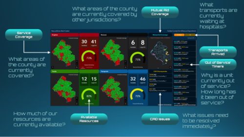
Our Fire and Rescue Department is constantly updating the ways it provides service to meet the needs of residents, including processing data that allows data-informed decisions about staffing and response. To meet these data goals, the department launched RescueVision to provide real-time situational awareness and decision support at the 911 dispatch center. RescueVision is a ...
fairfaxcounty.gov
New Interactive Climate Map Shows Impact Of Heat, Flooding In Fairfax County

New Interactive Climate Map Shows Impact Of Heat, Flooding In Fairfax County

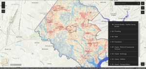
As Fairfax County finalizes its first-ever plan to address the future effects of climate change, community members can see how the phenomenon already affects them with a newly released interactive map. Launched last week, the climate map depicts heat and flooding data that can be viewed in conjunction with maps of the county’s population and ...
ffxnow.com