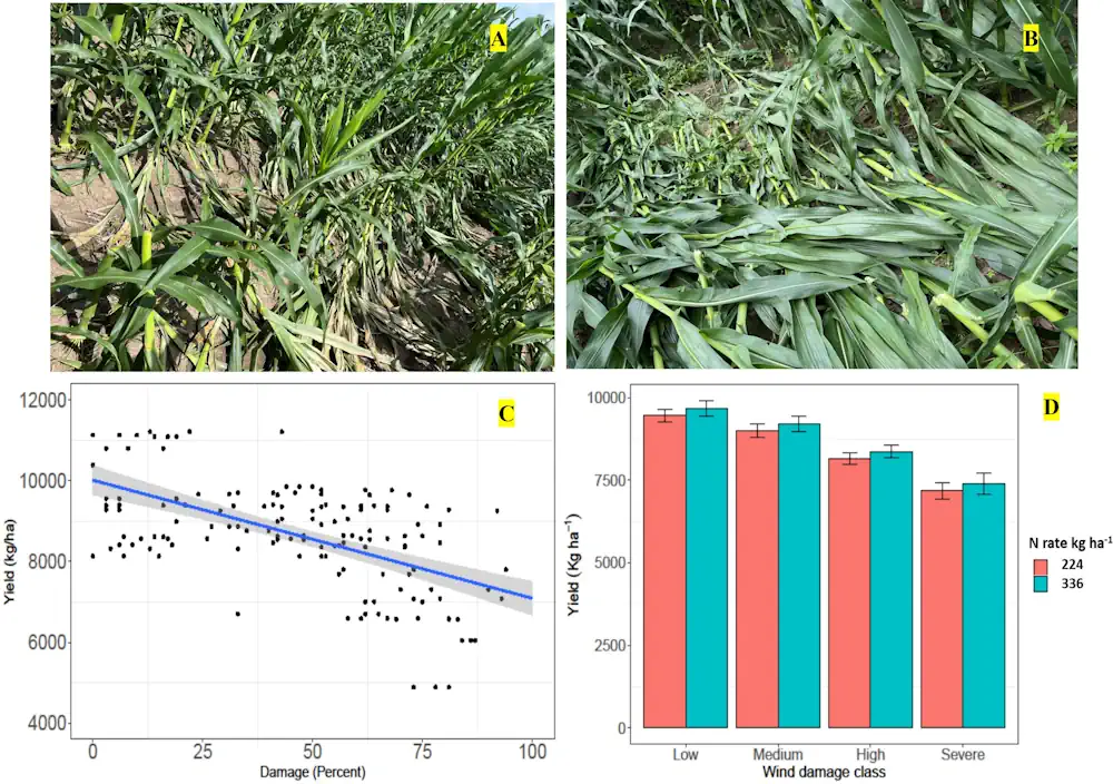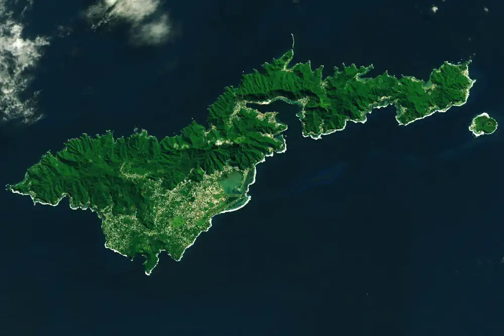
NASA Researchers Measure Sinking Land In American Samoa
On Sept. 29, 2009, an 8.1-magnitude earthquake struck near American Samoa, Samoa, and Tonga, triggering a tsunami that caused human casualties and $200 million in property damage on the islands. The earthquake also exacerbated another problem in American Samoa: subsidence, or the sinking of land. When combined with relative sea level rise, land sinking can ...
phys.org