Geomaticians

USA

New Mapping Techniques Rapidly Identified Hurricane Damage Across All Of Florida. Here’s How They Work

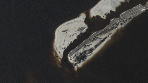
Hurricane Ian left an extraordinarily broad path of destruction across much of South Florida. That was evident in reports from the ground, but it also shows up in satellite data. Using a new method, our team of spatial and environmental analysts was able to quickly provide a rare big picture view of damage across the ...
fastcompany.com

Man Creates Mapping Tool To Help Locals Find Boston’s Best Dive Bars

If you’re looking for a place “where everyone knows your name”, a new mapping tool could help you find it. A lot of swanky bars and restaurants with plush lounges and expensive cocktails have opened around Boston. One local man prefers a reasonably priced draft and some home style cooking. He’s on a quest to ...
boston25news.com

Esri Partners With Digital Earth Africa To Support Sustainable Growth

Climate change is compounding risks of food insecurity, displacement, and natural disasters across broad regions of the African continent, with vulnerable populations facing especially grave outcomes. However, several countries in Africa are already innovating and driving the next big tech sector boom, with companies creating solutions to close social and economic gaps. To support local ...
geospatialworld.net
New Machine Learning Model Can Provide More Accurate Assessments Of Hurricane Damage For Responders

New Machine Learning Model Can Provide More Accurate Assessments Of Hurricane Damage For Responders

Emergency crews responding to hurricane-damaged areas may soon get an assist from a machine learning model that can better predict the extent of building damage soon after the storm passes. The model uses remote sensing from satellites that can generate building footprints from pre-hurricane images and then compare them with images taken after the storm. ...
techxplore.com

USAR Damage Assessment Map Gives Information And A Look At Properties On Sanibel Island

A map that shows damage levels to properties on Sanibel Island has been completed from the assessment of structures by Urban Search and Rescue Teams. The damage assessments show there is widespread damage on the island, causing dangerous conditions throughout Sanibel and particularly in and around various structures. Maps can be viewed by clicking here ...
news.wgcu.org

Purdue Team Introduces Advances In Automatic Forest Mapping Technology

How lightning travels from the sky to the ground inspired the concept behind a new algorithmic approach to digitally separate individual trees from their forests in automatic forest mapping. “When lightning travels from the sky to the ground, it finds the path of least resistance through the atmosphere,” said Joshua Carpenter , a Ph.D. student ...
wbiw.com
The Force Is Strong With Space Lasers Helping Researchers Map The Amazon In 3D

The Force Is Strong With Space Lasers Helping Researchers Map The Amazon In 3D

For decades, satellite images have clearly captured how rampant deforestation is destroying the Amazon rainforest. But what about the trees that remain standing? What do their dimensions tell us about our planet’s future? Quite a lot, in fact. Since 2018, a first-of-its-kind mission by NASA has deployed lasers mounted aboard the International Space Station to ...
news.mongabay.com
NASA, USGS Map Minerals To Understand Earth Makeup, Climate Change

NASA, USGS Map Minerals To Understand Earth Makeup, Climate Change

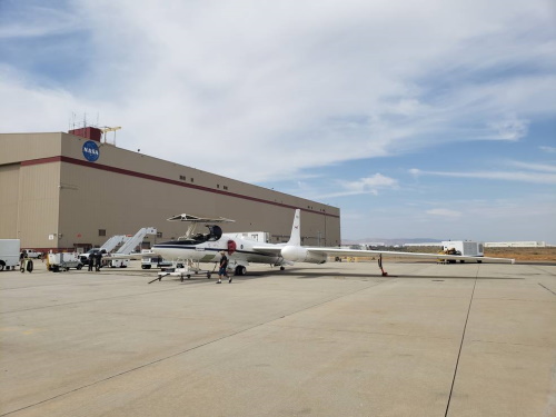
NASA and the U.S. Geological Survey (USGS) will map portions of the southwest United States for critical minerals using advanced airborne imaging. Hyperspectral data from hundreds of wavelengths of reflected light can provide new information about Earth’s surface and atmosphere to help scientists understand Earth’s geology and biology, as well as the effects of climate ...
nasa.gov

New Aerial Imagery Available For Crow Wing County Residents

Higher-resolution aerial imagery captured this spring for Crow Wing County is now available to residents. The imagery, captured through a flight by EagleView Pictometry , has a 2-inch resolution compared to the previous 6-inch resolution. “You will see when viewing at the street level or closer, the amount of detail visible compared to past aerial ...
brainerddispatch.com
September 2022 Hurricane Ian

September 2022: Hurricane Ian

On September 29, the National Geodetic Survey (NGS) began collecting aerial damage assessment images in the aftermath of Hurricane Ian. Imagery is being collected in specific areas by NOAA aircraft, identified by NOAA in coordination with FEMA and other state and federal partners. Collected images are available to view online via the NGS aerial imagery ...
oceanservice.noaa.gov

Albania Secures 2 Satellites To Monitor Territory From Space

Albania on Thursday reached a three-year agreement with an American company for a dedicated satellite constellation to provide the country with satellite imagery capabilities across its territory. The Albanian government signed the $6 million (6.2 million euros) deal with Satellogic USA Inc. of North Carolina, the prime minister’s office said. The agreement will give Albania ...
abcnews.go.com
IFCE Recebe Representante Da Nasa Para Projeto De Cooperação

IFCE Recebe Representante Da Nasa Para Projeto De Cooperação

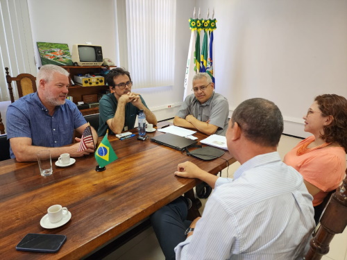
Instituto Federal do Ceará (IFCE), Nasa, Agência Espacial Brasileira (AEB), Universidade Federal Rural do Semi-árido (Ufersa-RN) e Universidade Mackenzie firmaram acordo para realizar experimentos e projetos conjuntos em nível de pesquisa, desenvolvimento e inovação (PD&I), e em pós-graduação. As ações serão voltadas ao estudo da geodésia do planeta Terra, modelagens do campo gravitacional, radioastronomia, além ...
ifce.edu.br
East Lansing To Use Cameras To Monitor Residents' Recycling Habits In Education Campaign

East Lansing To Use Cameras To Monitor Residents’ Recycling Habits In Education Campaign

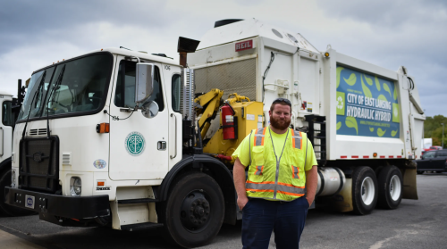
East Lansing is taking a direct approach to what it said is an effort to educate residents about recycling by using cameras to monitor what residents are putting in their recycling bins. Saskatchewan, Canada recycling technology company Prairie Robotics has installed cameras on the city’s recycling collection trucks that capture an image of what is ...
eu.lansingstatejournal.com

This Atlas Wants To Map Every Solar And Wind Source In Your Country

It’s easy to spot a wind turbine or solar array from the window of your car, but counting each installation across the world is quite a different story. And since neither the Paris Agreement nor the United Nations Sustainable Development Goals can possibly be fulfilled without a broad adoption of renewable energy sources, having a ...
planet.com
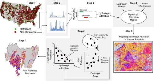
Researchers Map Streamflow Alterations To Gauge Human Impact On Ecosystems

Researchers Map Streamflow Alterations To Gauge Human Impact On Ecosystems

Altering streamflow can endanger the ecosystems that rely on it, but researchers have lacked data on how human infrastructure has impacted streamflow in the U.S. Now, a study involving a Colorado State University researcher has mapped streamflow alterations across the continental U.S., providing a wealth of data for determining societal impacts on ecosystems. Up to ...
phys.org

Maxar Offering New Space-monitoring Service To Help Track Objects In Orbit

Maxar Technologies, an operator of high-resolution Earth imaging satellites, has received regulatory approval to use its satellites to monitor the space environment and sell that data commercially. Having a license to offer non-Earth imagery allows commercial remote sensing satellites to observe objects such as other satellites and orbital debris. Maxar is looking to use this ...
spacenews.com
Kodiak Robotics Relies On Lightweight Mapping For Autonomous Truck PNT

Kodiak Robotics Relies On Lightweight Mapping For Autonomous Truck PNT

Kodiak Robotics, Inc. has been on a bit of a roll lately, developing automated solutions for long-haul truck routes in the southern parts of the U.S. The self-driving trucking company made a big announcement on that front in August, unveiling a partnership with Pilot Company, the largest travel center operator in North America, to develop ...
insidegnss.com

Now You Don’t Have To Wait For Smoke To Know Where Fires Are Likely To Occur

Scientists with the U.S. Department of Agriculture’s Agricultural Research Service (ARS) and the University of Montana have developed a way to forecast which of the Great Basin’s more than 60 million acres have the highest probability of a large rangeland fire. The forecasts come from a model developed by the researchers that combines measures of ...
ars.usda.gov
Try It Map Rates How Well Your Neighborhood Protects Cognition

Try It: Map Rates How Well Your Neighborhood Protects Cognition

Access to civic and social organizations, cultural centers such as museums and art galleries, and recreation centers may help protect against cognitive decline as a person ages, a new study suggests. A new interactive map allows you to plug in your address and assess how your neighborhood could support healthy cognitive aging, a theory the ...
futurity.org
Monitoring Forest Threats With New Open Forest Observatory

Monitoring Forest Threats With New Open Forest Observatory

Environmental managers will have a powerful new resource for helping our forests survive and recover from wildfire, drought and disease. UC Davis ecologist Derek Young is leading a team to develop the Open Forest Observatory, a pioneering project combining drone photography and forest mapping with machine learning, remote sensing, big-data crunching and open information sourcing. ...
ucdavis.edu
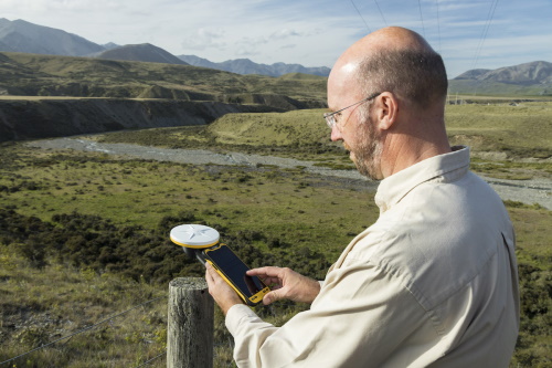
New Trimble Terraflex Software Edition Simplifies GIS Data Capture

New Trimble Terraflex Software Edition Simplifies GIS Data Capture

Trimble announced today the release of Trimble® TerraFlex Premium edition, a new tier of Trimble’s flagship Geographic Information System (GIS) data collection software. The edition provides customers with offline GNSS corrections, a new automated workflow that works exclusively with Trimble GNSS receivers—including the Trimble DA2 receiver for the Trimble Catalyst™ positioning service—to provide high-accuracy GIS ...
amerisurv.com
County Launches Online Tool To Help Older Residents Connect With A Volunteer Ride

County Launches Online Tool To Help Older Residents Connect With A Volunteer Ride

The county has launched an online tool to help older adult residents connect with volunteer ride providers to help them get to places they need to be when they need to be there, officials announced. “Mobility and accessibility to transportation options are critical to helping improve the quality of life for our older residents,” County ...
sourceofthespring.com

Surveillance Satellitaire : Unseenlabs S’associe À Un Spécialiste De L’analyse Géospatiale

La société française Unseenlabs, spécialisée dans les nano-satellites de géolicalisation, vient de conclure un partenariat avec Ursa Space Systems, un spécialiste de l’analyse géospatiale, pour fournir des solutions visant à la surveillance des espaces maritimes, dans un but de sûreté et de sécurité maritime. Ce nouveau partenariat vise à permettre permet d’améliorer la surveillance du ...
meretmarine.com

Orange County Government Launches Interactive Transportation Projects Dashboard

Today, Orange County Government launches an interactive map where residents can navigate and gather information relating to the proposed Transportation Initiative projects list. Residents can navigate the dashboard by scrolling through the site or using the navigation bar for direct links. The interactive map has a zoom feature and projects can be filtered by address, ...
newsroom.ocfl.net
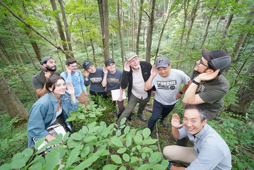
Assessing Global Biodiversity With Ears To The Ground, NASA Eyes In The Sky

Assessing Global Biodiversity With Ears To The Ground, NASA Eyes In The Sky

Purdue University professor Bryan Pijanowski’s research team will be working in some wild and remote places around the globe in the coming year. Pijanowski’s sound-source surveyors will be equipped with microphones, headphones and parabolic reflectors to efficiently collect sound waves from the natural world. Their tools also include low-flying drones and sensors mounted on orbiting ...
purdue.edu

Planet Partners With Taylor Geospatial Institute For Research On Food Security

Planet has entered into a multi-year contract with Saint Louis University in support of the Taylor Geospatial Institute (TGI), a leading geospatial research collaborative. Bringing together eight midwestern universities and research centers, TGI aims to harness innovation in geospatial science and make scientific discoveries that address global challenges. With access to Planet’s satellite data, TGI ...
geospatialworld.net

First-of-its-kind Digital Platform Reveals Migration Data For Birds Across The Western Hemisphere Just In Time For Fall Migration

As millions of birds are flocking to their wintering grounds, the Smithsonian Migratory Bird Center and nine partner organizations announced today the Bird Migration Explorer, a state-of-the-art digital platform that reveals migration data consolidated for 458 bird species found in the United States and Canada. The free, interactive platform, available in English and Spanish, allows ...
nationalzoo.si.edu

Hays County Rolls out GIS Data Portal

Hays County residents and other members of the public can now search and download Geographic Information System (GIS) data for Hays County. The new online portal, developed by the GIS Division within the Hays County Development Services Department, provides a range of data including precinct voting maps, election polling locations, 2020 parks bond projects, floodplain ...
hayscountytx.com

SLU, NGA to host annual Geo-Resolution Conference focusing on climate change

The National Geospatial-Intelligence Agency (NGA) and Saint Louis University (SLU) will co-host the annual Geo-Resolution conference Wednesday, Sept. 28, at SLU. Geo- Resolution is an annual conference that encourages collaboration between government, academic and industry partners to foster geospatial technology innovation and applications, connect geospatial experts and students, and grow the geospatial ecosystem in the ...
newswise.com

Leading Space Innovators Join Forces To Create World’s First Satellite With Both SAR And Optical Payloads To Revolutionize Geospatial Imaging

Antaris, the software platform provider for space, and GalaxEye, an imaging satellite operator, today announced the signing of a Memorandum of Understanding to create the world’s first satellite featuring both SAR and optical sensors on a single satellite. The MOU highlights a unique commitment between three Indian space leaders—GalaxEye, Ananth Technologies and XDLINX Labs—and US-based ...
spaceref.com