Geomaticians

USA

Two New Drone LidarImagery Systems From TrueView

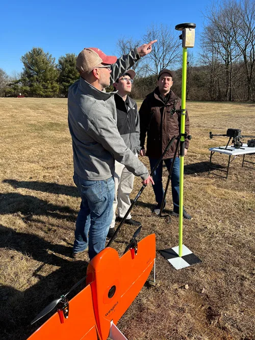
Two New Drone Lidar/Imagery Systems From TrueView

From the floor of Geo Week 2023, LiDAR mapping hardware & software company GeoCue announced new products for geospatial professionals. Frank Darmayan, CEO of GeoCue explains “Our new TrueView 535 builds upon the success of our best-selling TrueView 515 with several improvements; the upgraded LiDAR sensors adds a 3rd return which increases our ability to ...
amerisurv.com

Ursa Space Launches Python Toolbox API On Esri ArcGIS Pro

Ursa Space Systems announced the release of a Python toolbox for satellite analytics and data ordering within Esri ArcGIS Pro, a full-featured professional desktop GIS application. Ursa Space leverages the world’s most comprehensive and progressive satellite data virtual constellation, comprising synthetic aperture radar (SAR), Optical, and radio frequency (RF) sensing from multiple commercial sources and ...
geospatialworld.net

Missouri 911 Service Board Initiates First Ever 6-inch Resolution Statewide Imagery Program With Extensive Buy-up Options

Recognizing the importance to public safety and to many other government operations of high-quality aerial imagery, the Missouri 911 Service Board has partnered with the Department of Conservation, the Department of Natural Resources, and the Missouri GIS Advisory Council to launch a statewide imagery collection program. The imagery will be available at no charge through ...
businesswire.com

Maxar Signs Agreement With Umbra For Direct Access To Radar Imaging Satellites

Maxar has signed a contract with satellite imagery startup Umbra to get dedicated access to the company’s radar imaging constellation, the companies announced Feb. 14. The partnership will allow Maxar to directly task Umbra’s satellites and integrate synthetic aperture radar (SAR) data into its portfolio of Earth intelligence products and services, Tony Frazier, head of ...
spacenews.com

Presentation Proposals Invited For GIS-Pro 2023

URISA’s 61st Annual Conference, GIS-Pro 2023, will be hosted in Columbus, Ohio, in partnership with the Ohio Valley Chapter of URISA. We are pleased to invite presentation proposals from the geospatial community. The conference content will be curated by a planning committee comprised of more than 50 GIS professionals from Ohio, the Great Lakes region, ...
directionsmag.com
Bluesky Geospatial Launches MetroVista 3D Aerial Mapping Program In U.S.

Bluesky Geospatial Launches MetroVista 3D Aerial Mapping Program In U.S.

Bluesky Geospatial Ltd. has announced the launch of its MetroVista 3D aerial mapping program in the United States. The service employs a hybrid imaging-LiDAR airborne sensor to capture highly detailed 3D data, including 360-degree views of buildings and street-level features, in urban areas for use in creating digital twins, visualizations, and simulations. Bluesky’s sister company, ...
amerisurv.com
Ominous Green Lasers Shot Over Hawaii Didn't Come From NASA Satellite After All

Ominous Green Lasers Shot Over Hawaii Didn’t Come From NASA Satellite After All

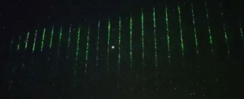
Above the islands of Hawaii on January 28, a green laser was seen piercing the night sky, silently tracing a path towards the horizon like a stutter in the Matrix’s code. The scene was caught on camera from a telescope atop Hawaii’s tallest peak. Originally, experts at the National Astronomical Observatory of Japan (NAOJ), which ...
sciencealert.com

Esri Releases New App To Easily View And Analyze Global Land-Cover Changes

Esri, the global leader in mapping and location intelligence, has now released a new online application, Sentinel-2 Land Cover Explorer. The app is structured around a web-based version of its own high-resolution global land-cover map, derived from European Space Agency (ESA) Sentinel-2 satellite imagery. The app is easy to access and leverages the same geographic ...
geospatialworld.net
Alphartk Announces Free Educational RTK Access

Alphartk Announces Free Educational RTK Access

AlphaRTK, a real-time kinematic (RTK) service provider, announced today it will provide students and faculty of Rutgers University, West Chester University, and Warren County Community College free access to its global navigation satellite system (GNSS) correction network. AlphaRTK is the most affordable, privately held, RTK subscription network to fully support four-constellation GNSS corrections. The service ...
geospatialworld.net

Google Maps Delivers Stunning And Immersive Experience With Its Latest Update

Over the past year, Google Maps has really evolved, offering impressive features, that provide more immersive experiences. Now the firm is taking things to another level, leveraging AI and computer vision to take you places that you never thought possible within Google Maps. While you could previously take an aerial tour of locations, you’ll now ...
xda-developers.com

Revisions To The ASPRS Positional Accuracy Standards For Geospatial Data (2014) Seeking Public Comments

The American Society of Photogrammetry and Remote Sensing is revising the ASPRS Positional Accuracy Standards for Digital Geospatial Data for publication as a 2nd Edition and we are seeking public opinion on the proposed changes. Revising the standard is an important and necessary process, as technologies and practices are evolving. The updating of these standards ...
directionsmag.com

IBM, NASA Collaborate For Climate Change Research

IBM and NASA are collaborating for initiating improved climate change research. It was announced on February 1, that IBM is going to work together with NASA’s Marshall Space Flight Center to use artificial intelligence for climate change research in an effort to greatly improve research analysis of these large datasets. The aim is to make ...
geospatialworld.net

Esri Signs Space Act Agreement With NASA

The agreement focuses on extending access to the broader global community of NASA’s geospatial content for continued research and exploration—including new datasets from nearly 100 spaceborne sensors, measuring atmospheric health, land-based phenomena, and characteristics of the oceans. Partner efforts under this agreement will add to the existing NASA data in ArcGIS Living Atlas of the ...
geospatialworld.net
New Tool Reveals Best Places For Clean Energy Developments In The US

New Tool Reveals Best Places For Clean Energy Developments In The US

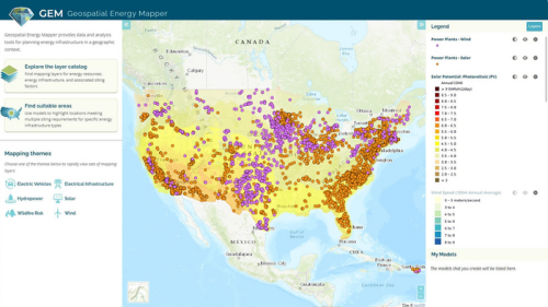
Researchers at the Argonne National Laboratory have developed an interactive online mapping tool that can help identify areas across the United States that are suitable for wind, solar, and other clean energy infrastructure projects. First publicly launched in 2013 as the Energy Zones Mapping Tool (EZMT), the solution has been redesigned, rebranded as Geospatial Energy ...
mining.com
DARPA Wants To Push The Boundaries Of Where Satellites Can Fly

DARPA Wants To Push The Boundaries Of Where Satellites Can Fly

DARPA defined Very Low Earth Orbit (VLEO) as orbits less than 450 km, or roughly 280 miles, in altitude. Low Earth Orbit, by contrast, is 2,000 km or 1,200 miles. The benefits of being in Very Low Earth Orbit include, according to DARPA, “improved spatial resolution for optical imaging, higher signal-to-noise ratios for radar and ...
popsci.com

Hexagon Announces New Platform For Defense Mobile App

Hexagon Announces New Platform For Defense Mobile Apps

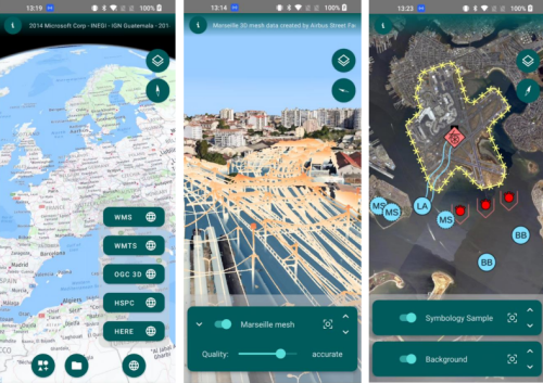
Hexagon’s Safety, Infrastructure & Geospatial division has introduced LuciadCPillar for Android, a platform for developing mobile applications for dismounted soldiers in the field. The new Android platform enables developers to build applications with 2D/3D views, featuring military symbology and supporting many geospatial data types, including vector data, raster data, elevation data, point clouds and 3D ...
directionsmag.com
Airborne Surveys Launched In Chile To Detect Sources Of Methan

Airborne Surveys Launched In Chile To Detect Sources Of Methane

Airborne surveys have been launched in Chile to detect sources of methane by Carbon Mapper, a California based nonprofit. This survey aims to point sources that potentially emit disproportionately high volumes of methane and therefore offer important mitigation opportunities. This survey kicks off a broader initiative to conduct airborne methane surveys in the Latin American ...
geospatialworld.net

MSCI Partners With Google Cloud To Build A Secure Global Investment Data Platform In The Cloud

As part of its commitment to improving the client experience through technology and relentless innovation, MSCI Inc. today announced a strategic alliance with Google Cloud to build a cloud-native investment data acquisition and development platform, aimed at delivering data, insights, and solutions to power better and faster investment decision making. MSCI’s use of Google Cloud’s ...
businesswire.com
Fire Hazard Map Review Period Extended Following Cal Cities’ Advocac

Fire Hazard Map Review Period Extended Following Cal Cities’ Advocacy

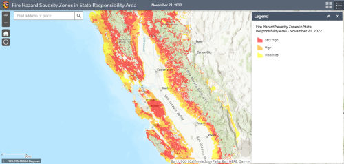
The California Department of Forestry and Fire Protection (Cal FIRE) has granted stakeholders an additional 60 days to comment on the state’s draft Fire Hazard Severity Zone Map for rural, unincorporated areas (State Responsibility Area). The move was made in response to a request for more time and clarity from the League of California Cities ...
calcities.org
Liang grant (Purdue University Agrcultural Communications photo)

Purdue Launches New AI-based Global Forest Mapping Project

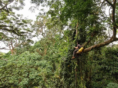
Purdue University’s Jingjing Liang has received a two-year, $870,000 grant from the World Resources Institute to map global forest carbon accumulation rates. “To accurately capture the carbon accumulation rates of forested ecosystems across the world has always been a challenging task, mostly because doing so requires lots of ground-sourced data, and currently such data are ...
purdue.edu
Midwest Farmers Using Cover Crops Take Small Yield Hit

Midwest Farmers Using Cover Crops Take Small Yield Hit

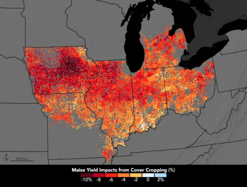
Most farm fields in the U.S. Midwest lay bare over the winter. From the time of corn and soybean harvests—sometime between September and December—until the planting season in spring, valuable topsoil is often unprotected. Wind, snowmelt, and rain can remove topsoil and nutrients from fields and carry them into the Mississippi River, where, instead of ...
earthobservatory.nasa.gov

Inside The Department Of Energy Project Using Drones To Map Radioactive Waste Storage Vaults

Flyability’s Elios 3 has successfully completed a 3D mapping operation of a radioactive waste storage vault following more than a year of preparation and research. The information obtained in the mapping project will prove crucial to planning the vault’s removal. This is thought to be the first time a drone has been deployed to enter ...
dronelife.com

Strava Will Add High-res 3D Maps For Outdoor Activities

Strava routes are about to get three-dimensional. The popular fitness social network announced today that it’s acquired Fatmap, a mobile app known for its 3D maps for outdoor sports like hiking, trail running, skiing, and mountain biking. “Fatmap tech will power Strava maps for both free members and subscribers,” Strava spokesperson Brian Bell told The ...
theverge.com

Mysterious White Clouds Keep Popping Up Near The Bahamas, And No One Knows Why

The perplexing patches of light-colored ocean are sometimes noticed in other oceans and lakes worldwide, but in the Bahamas, they pop up more often than usual. Direct sampling of the cloudy waters suggests they contain high concentrations of carbonate-rich particles. Much of the Bahama archipelago sits on a submerged platform of carbonate known as the ...
sciencealert.com

HERE, AWS Provide Device Positioning Services To Developers

HERE Technologies, a location data platform, announced its collaboration with Amazon Web Services (AWS), a cloud platform. This collaboration will deliver improved performance for indoor and outdoor positioning capabilities, enabling AWS third-party developers to track and manage internet-of-things (IoT) devices. HERE Positioning enables developers to switch between different localizing technologies, and it relies exclusively on ...
geospatialworld.net
Sharks, Spatial Data, And A Conservation Success Story

Sharks, Spatial Data, And A Conservation Success Story

It’s hard out there for a shark. A critical barometer to the health of ocean ecosystems, shark and ray populations have faced significant global declines from overfishing, habitat loss, and environment degradation. Add to the mix a slow reproductive cycle and the broader logistical challenges of trying to monitor animals with ranges that can exceed ...
phys.org

Topcon Provides GNSS Correction Services In California

In response to recent disaster declarations throughout California, Topcon Positioning Systems is offering free access to its global navigation satellite system (GNSS) correction services network to essential emergency response agencies and personnel in designated disaster areas. “The challenge for a lot of these companies, services and agencies that come into disaster areas is they don’t ...
geospatialworld.net
Scientists Can Now Use WiFi To See Through People's Wall

Scientists Can Now Use WiFi To See Through People’s Walls

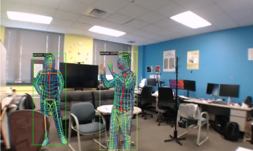
It isn’t immediately clear how using only a WiFi signal to track human movement through walls improves personal privacy … but that’s what a new study from Carnegie Mellon University claims. In a recently published paper, the researchers expanded on the study of employing WiFi signals to map human movement, especially in low-light situations that ...
popularmechanics.com

Intermap Announces New Flood Modelling Initiative In Thailand

Intermap Technologies announced the development of a flood modelling initiative and enhanced Digital Elevation Model (DEM) datasets in Thailand. Using a combination of satellite imagery, radar data and ancillary inputs, Intermap will create an extensive, detailed flood map and precision elevation model for the greater Bangkok area. Bangkok itself is sinking due to urban development ...
geospatialworld.net
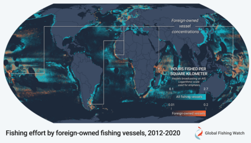
New Research Reveals Shifting Identities Of Global Fishing Fleet To Help Bolster Fisheries Management

New Research Reveals Shifting Identities Of Global Fishing Fleet To Help Bolster Fisheries Management

A new study published today in Science Advances combines a decade’s worth of satellite vessel tracking data with identification information from more than 40 public registries to determine where and when vessels responsible for most of the world’s industrial fishing change their country of registration, a practice known as “reflagging”, and identify hotspots of potential ...
eurekalert.org