Geomaticians

North Carolina

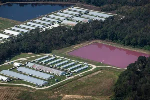
New EWG Research Finds Many North Carolina Factory Farms Are At Risk Of Flooding

New EWG Research Finds Many North Carolina Factory Farms Are At Risk Of Flooding

A new Environmental Working Group geospatial analysis finds over 2 percent of North Carolina’s 7,352 swine and poultry factory farms are in or just outside floodplains. When these farms flood, they can contaminate water with bacteria and other health hazards. “The 156 factory farms we found in and near North Carolina’s floodplains are at a ...
ewg.org

Hexagon Announces Aerial Data Collection Of Eight US States

Hexagon’s Geosystems division announced today that the HxGN Content Program will refresh data for eight U.S. states during this year’s collection season. All states — California, New York, Pennsylvania, Oregon, Kentucky, Michigan, North Carolina, and West Virginia — will be updated at a 6-inch (15-centimeter) resolution statewide, marking the program’s shift from a 12-inch to ...
geospatialworld.net