New Mapper Opens Up Access To Flood Planning In New York State
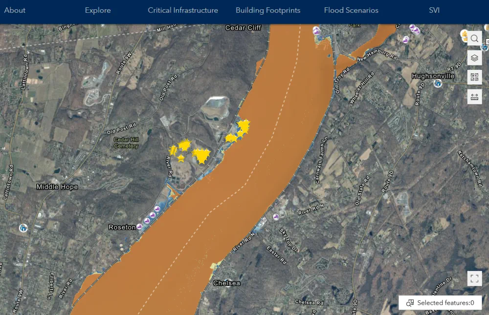
An accessible new mapping tool will make it easier for individuals and communities to plan for flooding and sea level rise. Developed by the NASA Socioeconomic Data and Applications Center (SEDAC) at Columbia Climate School’s CIESIN, the mapper visualizes spatial data for infrastructure across nearly all of New York State, except New York City. The ...
news.climate.columbia.edu