Geomaticians

Illinois

New SLU And NGA Research Aims To Create The Authoritative Map Of Cahokia Mounds

New research from St. Louis University and the National Geospatial-Intelligence Agency aims to create the most authoritative 3D map of Cahokia Mounds in order to better inform future studies of the famed prehistoric site. The researchers are using drones and Light Detection and Ranging technology, known as lidar, to better identify previously unmapped portions of ...
stlpr.org

Chicago Uses Tech, Resident Input To Improve Services

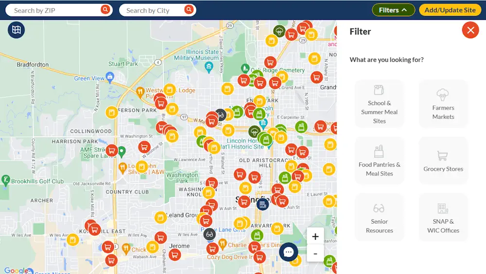
The map-based Chicago Recovery Plan was created with feedback from residents. It also allows them to track progress on city projects to create safe neighborhoods and drive equitable economic growth. Launched in May 2023, the tool is “opening the books on neighborhood investments in a simple, accessible digital format,” Chief Technology Officer Nick Lucius said ...
govtech.com
Interactive Map Helps People Find Food And Resources In Illinois

Interactive Map Helps People Find Food And Resources In Illinois

Technology is helping folks with their daily lives find their basic needs. The Find Food IL Map is a digital tool created in response to the COVID-19 pandemic, but it will likely stick around as food insecurity becomes more prevalent. When the pandemic hit, many families found themselves grappling with a new reality – a ...
ksdk.com
Map Of Crimes In Park Ridge Will Update Every Week, Per Police

Map Of Crimes In Park Ridge Will Update Every Week, Per Police

The Park Ridge Police Department has rolled out an interactive map to track where criminal activity takes place across Park Ridge. The map, available on the Park Ridge Police Department website, is a response to a request from aldermen earlier this year to have a better idea of where crimes are occurring in Park Ridge. ...
chicagotribune.com