Geomaticians

Connecticut

Mapping Connecticut's Understory From Outer Space

Mapping Connecticut’s Understory From Outer Space

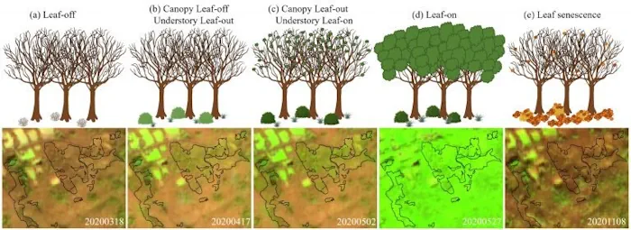
Distinguishing separate plant species from one another is hard even for human eyes; however, a team of UConn researchers was able to use data from a satellite nearly 500 miles (786km) above Earth’s surface to map Connecticut’s forest understory plant communities. The results of this study are published in Remote Sensing of Environment. The understory, ...
phys.org

Office Of Policy And Management Announces Launch Of Two Geographic Information System Websites

The Connecticut Office of Policy and Management (OPM) today announced that that the state’s new Geodata Portal and broadband maps will be available beginning on Friday, November 18, 2022. This announcement comes on GIS Day 2022, which helps others learning about geography and the real-world applications of GIS that can make a difference in our ...
portal.ct.gov