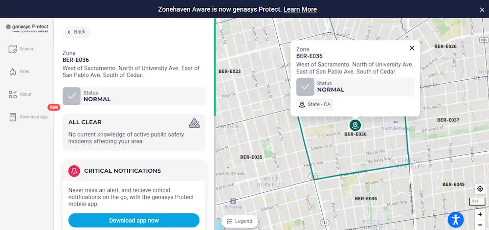
Use Berkeley’s Emergency Map To Find Critical, Real-time Information By Location
Learn how to use the City’s Emergency Map to quickly see how neighborhoods, including your own, may be directed to evacuate, shelter in place, or take other protective action during a major emergency. When possible, the City would use the map to also identify evacuation routes, road closures, shelters, or other critical information to guide ...
berkeleyca.gov