Geomaticians

Scotland

New interactive map showcases publicly-owned land across Scotland

New interactive map showcases publicly-owned land across Scotland

A NEW interactive map highlighting information about publicly-owned land across Scotland has been created. The new resource – which can be found HERE – also allows people to see the land managed by the Scottish Crown Estate. Users can explore information on individual land parcels, including its ownership and size. The information has been brought together as ...
thenational.scot
Nature Discovery Map Scotland Making The Outdoors Your Classroom

Nature Discovery Map Scotland Making The Outdoors Your Classroom

The Nature Discovery Map Scotland (NDMS) is designed to engage and empower students to maximise their school grounds and improve them for nature and climate resilience. This interactive mapping toolkit has been co-designed with teachers to help support Learning for Sustainability (LfS). This versatile toolkit can be used in many ways and on many levels ...
nature.scot

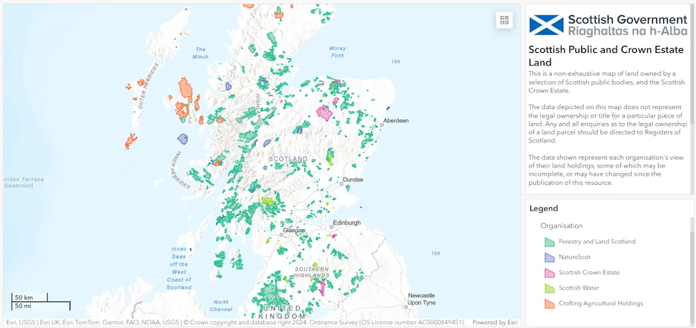
Scotland’s Spatial Hub Becomes Open Data

Scotland’s Improvement Service (IS) has launched open access to the Spatial Hub, making it available beyond the public sector to anyone. It said the hub, which is run by the Spatial Information Service and brings together a wide range of data directly from local authorities and partner organisations, has been made more widely available due ...
ukauthority.com