Geomaticians

UK

Synspective And Insight Terra Announce Space-enabled Data And Monitoring Solution For Mine Tailings Facilities

Synspective, a Tokyo based SAR (synthetic aperture radar) satellite data and solutions provider, and Insight Terra, a London based start-up providing a cloud based environmental and infrastructure risk management platform and solutions, have entered into a strategic partnership to deliver a new space enabled data and monitoring solution for the mining industry. The solution uses ...
realwire.com

European Space Agency Backs Geospatial Project To Protect Utilities

MGISS, a UK geospatial company, aims to understand how satellite imagery can identify areas where developments could disrupt gas and water supply. The Interruption Prevention Alert Service project will use satellite data and services to automatically detect changes to the built environment in order to prevent outages in critical utilities. The company argued that a ...
placetech.net

U.K.’S Highly Touted Space Launch Fails To Reach Orbit Due To An ‘Anomaly’

The rocket was set to make history, carrying satellites on what would be the first-ever orbital launch from the U.K. on Monday night. But Virgin Orbit says its LauncherOne rocket “experienced an anomaly” just before it could deliver its payload, and the craft was lost. Virgin Orbit says it’s reviewing the flight data to determine ...
ideastream.org

Previsico Leverages Next-gen Satellite To Enhance Flood Alerts

Live flood alert InsurTech platform Previsico has partnered with the new €4.3bn Meteosat Third Generation satellite system. This new system will allow Previsico to be more accurate and timelier with flood warnings, providing insurers and property owners with more time to mitigate flood impacts. The first satellite of the new generation was launched on 13 ...
fintech.global
Esri's GIS Helps Vodafone Create National Digital Twin

Esri’s GIS Helps Vodafone Create National Digital Twin

Vodafone has created a 3D digital twin of its UK mobile mast network to allow its engineers to visualise and strategise network improvements or expansion. It will allow them to make instant decisions to improve services to customers without leaving their desks. The digital twin involved mapping more than 40 million environmental features using advanced ...
directionsmag.com
Web Mapping To Support The National Forest’s 25-year Vision

Web Mapping To Support The National Forest’s 25-year Vision

The National Forest Company (NFC) has awarded Cadcorp the contract to provide Cadcorp SIS Desktop, and cloud hosted Cadcorp SIS WebMap and Cadcorp Spatial Database Service. The contract includes a variety of services such as application management, support, and training. The National Forest covers 200 square miles of the Midlands. Since 1995, over 9 million ...
directionsmag.com
University Of Plymouth Integrates Geoacoustics Sub-bottom Profiler Into Hydrography Programmes

University Of Plymouth Integrates Geoacoustics Sub-bottom Profiler Into Hydrography Programmes

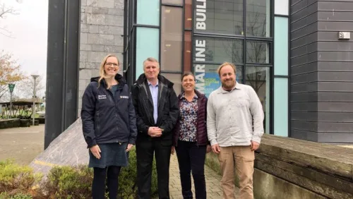
The University will take delivery of the system, which includes an Over-the-Side (OTS) transducer mount for deployment flexibility, this December. The partnership also includes the potential to switch to a next-generation GeoPulse system in 2023 as well as a one-day guest lecture and processing workshop for the University’s MSc Hydrography and BSc Ocean Exploration and ...
hydro-international.com

New Device Can Control Light At Unprecedented Speeds

An international group of researchers, led by a team at MIT, has developed a programmable, wireless device that can control light, such as by focusing a beam in a specific direction or manipulating the light’s intensity and doing it orders of magnitude more quickly than commercial devices. Their device, called spatial light modulator, could create ...
techexplorist.com
Esri UK Provides Mapping Expertise For DfE’s Major New Climate Project

Esri UK Provides Mapping Expertise For DfE’s Major New Climate Project

The Department for Education (DfE) has released further details of its National Education Nature Park, created to teach children of all ages about climate change and improve biodiversity across the country. Esri UK is providing a digital mapping platform and expertise in biodiversity mapping to help underpin this exciting initiative, first announced at COP26 by ...
geospatialworld.net

Japan Space Imaging Corporation Signs Deal With Satellite Vu

British satellite operator Satellite Vu, has signed a multimillion pound purchase option with Japanese satellite remote sensing commercial services provider Japan Space Imaging Corporation (JSI), following the opening of Satellite Vu’s Early Access Option Programme (EAOP), the company said. Trough the EAOP customers and partners gain access to Satellite Vu’s imagery, products, and services. They ...
spacewatch.global

UK Launches New Geospatial Data Projects

The UK’s Geospatial Commission has launched a series of projects to explore key land use pressures, such as energy, housing and decarbonisation, and how innovative data analysis can support better decisions about land use change. Through the National Land Data Programme, the Geospatial Commission is convening regional pilots, national roundtables and expert workshops to bring ...
spatialsource.com.au

BVI Launches Comprehensive Soil Study

BVI Launches Comprehensive Soil Study

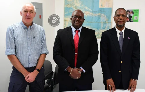
The Department of Disaster Management (DDM) will be carrying out a study of soils throughout the Territory as part of a Darwin Plus-funded research project launched this week. The study will be conducted in partnership with other government agencies, the H. Lavity Stoutt Community College, and the University of Portsmouth (United Kingdom). The study will ...
bvi.gov.vg

TGN: The Getty Thesaurus of Geographic Names

TGN is a thesaurus. TGN is not a geographic information system (GIS), although it may be linked to existing major, general-purpose, geographic databases and maps. While most records in TGN include coordinates, these coordinates are approximate and are intended for reference (“finding purposes”) only (as is true of coordinates in most atlases and other resources, ...
getty.edu

Likelihood Of Receiving An Autism Diagnosis May Depend On Where You Live

New autism diagnoses tend to be clustered within specific NHS service regions, suggesting that where an individual lives may influence whether they receive an autism diagnosis and access to special education needs support. The latest findings, from researchers from the University of Cambridge in collaboration with researchers from the London School of Economics and Political ...
cam.ac.uk

Mapping The Pressures Of Global Food Production

A map showing the environmental pressures from global food production has been developed by researchers, to identify ways of creating more sustainable and just food systems. The analysis looked at greenhouse gas emissions, water use, habitat disturbance and pollution, such as effluent or fertiliser run off from farms. The study, by the University of Leeds ...
leeds.ac.uk

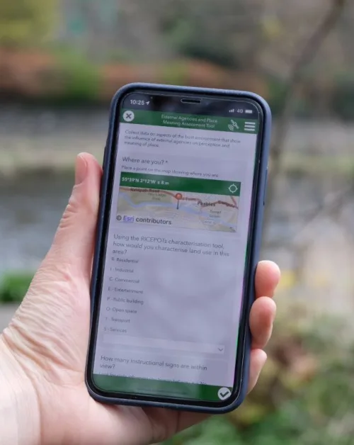
Online ‘Warm Spaces’ Map To Help Residents In Leeds Goes Live

An online map showing the locations of ‘warm spaces’ in Leeds to help people with the cost of living crisis has gone live today. The map, which can be seen at Warm Spaces Public app – embed (arcgis.com), shows the venues across the city which people are able to visit to keep warm to reduce ...
news.leeds.gov.uk
New Interactive Map Showcases Buildings And Places That Shaped The BBC

New Interactive Map Showcases Buildings And Places That Shaped The BBC

From the inspiration for Dr Who’s TARDIS to the filming location for CBBC’s Balamory, the people, places and buildings that have defined the BBC have been highlighted as part of a new digital map available this autumn. Today (13 October), Historic England, Historic Environment Scotland (HES), Historic Environment Division, Northern Ireland Communities Department and Cadw, ...
historicenvironment.scot
Dubai Municipality, Ordnance Survey Sign Geospatial Agreements

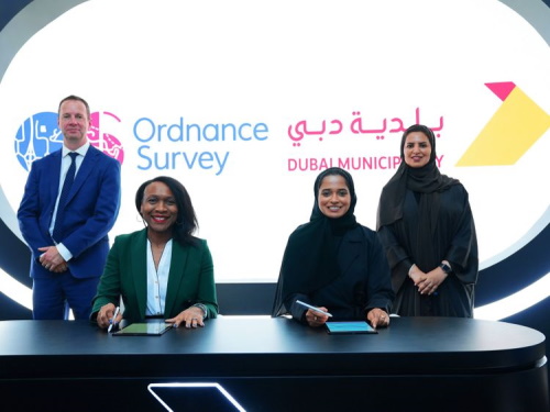
Dubai Municipality, Ordnance Survey Sign Geospatial Agreements

Dubai Municipality has signed two contracts with Ordnance Survey, Great Britain’s national mapping agency, to benefit from global geospatial expertise and support teams working in monitoring activities, buildings permits, survey services, executive planning, and geographic information systems. Paul French, Ordnance Survey chief commercial officer, said: “Dubai Municipality is at an exciting time in expanding its ...
gulfnews.com
Mcdonald's 'Mcbroken' Map Reveals Where Ice Cream Machines Are Broken In The UK

Mcdonald’s ‘Mcbroken’ Map Reveals Where Ice Cream Machines Are Broken In The UK

McDonald’s is the nation’s favourite fast food restaurant, enjoyed by Brits young and old with Big Macs, Quarter Pounders and of course, the chicken nuggets, firm favourites when in the mood for a quick bite. But there is one thing that gripes us all, the regularity of broken ice cream machines. There is nothing worse ...
thewestmorlandgazette.co.uk

Project Update On National Underground Asset Register Published

The Geospatial Commission publishes a project update on the National Underground Asset Register (NUAR) and invites participation from all asset owners in Northern Ireland and England. This publication marks the first anniversary of the build phase and provides a summary of progress over the past year, as well as the economic case and a timeline ...
gov.uk

New Geological Map Of Offshore Anglesey Released

The British Geological Survey (BGS) has released a new fine-scale digital map featuring the seabed geology of offshore Anglesey. The island (in Welsh known as Ynys Môn) follows the Bristol Channel as the second in a series of new fine-scale maps that contain combined bedrock, sediment, bedrock structure and seabed geomorphology data. The maps are ...
hydro-international.com

Celestia UK Will Develop LEO Satellite PNT System With ESA Funding

ESA has awarded an €800,000 NAVISP (Navigation, Innovation and Support Program) contract to Celestia UK for the development of an innovative PNT solution, based on LEO satellite constellations for 5G networks and applications. The project will use LEO satellite signals to provide a resilient position and time reference for 5G networks, boosting the reliability and ...
insidegnss.com

Ships Release Invisible Contrails That Slightly Cool The Climate

Peter Manshausen at the University of Oxford and his colleagues have found that clouds that had appeared unaffected are in fact affected by the aerosols. The researchers mapped the paths of two million ships in the Atlantic Ocean over a six-year period and used a global database for the winds on the trade routes the ...
newscientist.com

AGI Announces Last Chance To Secure Geocom Early Bird Booking Discounts

The UK membership organisation for companies and individuals working in the geospatial sector, the Association for Geographic Information, has announced an extension to the early bird booking discount for its flagship event GeoCom. The Association has also published the final agenda for its first in person annual conference in three years, with headline speakers from ...
directionsmag.com

Aylesbury Vale Residents Can Now Find Out If You Need Planning Permission Online As New Council Service Goes Live

The service is part of a national pilot by the Department for Levelling Up, Communities and Housing (DLUCH) to improve submitting and processing planning applications. The new service works by doing a high-level check of the project against legislation and Geographic Information System (GIS) data to see if the project may fall under ‘permitted development’. ...
bucksherald.co.uk

Developers Invited To The 2022 Joint OGC & ISO/TC 211 Code Sprint: The Metadata Code Sprint

The Open Geospatial Consortium (OGC) and Technical Committee 211 (TC 211) of the International Organization for Standardization (ISO) invite software developers to the 2022 Joint OGC & ISO/TC 211 Code Sprint aka The Metadata Code Sprint. Registration closes September 11. The hybrid online and in-person Sprint will focus on OGC API – Records, STAC, ISO ...
directionsmag.com
Next Generation Atomic Clocks Are A Step Closer To Real World Applications

Next Generation Atomic Clocks Are A Step Closer To Real World Applications

Working in collaboration with and partly funded by the UK’s Defence Science and Technology Laboratory (Dstl), a team of quantum physicists have devised new approaches that not only reduce the size of their clock, but also make it robust enough to be transported out of the laboratory and employed in the ‘real world’. Quantum—or atomic—clocks ...
phys.org

Airbus And Northrop Grumman Sign MOU For Future UK Milsatcoms

Airbus and Northrop Grumman have today signed a Memorandum of Understanding covering their intention to address the UK Ministry of Defence’s (MOD) SKYNET Enduring Capability (SKEC) military satellite communications requirements as an integrated joint team.
geospatialworld.net
US-European Satellite Will Make World’s First Global Freshwater Survey

US-European Satellite Will Make World’s First Global Freshwater Survey

Water is life, but for all its importance, humanity has a surprisingly limited view of Earth’s freshwater bodies. Researchers have reliable water level measurements for only a few thousand lakes around the world, and little to no data on some of the planet’s important river systems. The upcoming Surface Water and Ocean Topography (SWOT) satellite ...
jpl.nasa.gov

Reverse-engineering Insect Brains To Make Robots

British startup Opteran, a spin–out of the University of Sheffield, has a completely different view of neuromorphic engineering compared to most of the industry. The company has reverse–engineered insect brains to derive new algorithms for collision avoidance and navigation that can be used in robotics. Opteran calls its new approach to AI “natural intelligence,” taking ...
eetimes.com