Geomaticians

Dubai

Dubai Municipality Launches Digital Platform Empowering Senior Leaders With Customer Requests

Dubai Municipality has launched an innovative ‘Services 360’ policy digital platform, leveraging cutting-edge technologies and Geographic Information System (GIS), to provide its senior leaders and executives with real-time insights into customer requests and communications. This innovative platform empowers executives to oversee the progress of specialised tasks, ensure adherence to the highest service standards, and accelerate ...
wam.ae

Dubai Municipality Launches New Online System For Building Permits Services

Dubai Municipality has announced the launch of a new online system for building permits and control services aimed at streamlining procedures for customers in the emirate. The new system not only complies with the latest BIM standards and geographic information systems, but also facilitates user registration through digital ID and instant recognition. It enables smart ...
zawya.com

Dubai Signs Deal To Enhance Drone Flight Routes

The Dubai Civil Aviation Authority (DCAA) and Dubai Municipality announced the signing of a Memorandum of Understanding (MoU) to collaborate on the Dubai Horizons project. The new initiative focuses on the planning of drone flight routes and landing sites. Over a three-year period, both parties will combine their expertise in generating geospatial data for the ...
itp.net

Dubai Municipality Launches 3D Infrastructure

H.E. Dawoud Al Hajri, Director General of Dubai Municipality, said: “The project will undertake a comprehensive study on choosing advanced technologies to build a 3D model and an inclusive map of geospatial data on infrastructure and service lines below the ground, integrating all the precise details within a single source of information. The study will ...
mediaoffice.ae
بلدية دبي تُعلن عن إطلاق حاضنة الأعمال والابتكار الجيومكانية جيوهب

بلدية دبي تُعلن عن إطلاق حاضنة الأعمال والابتكار الجيومكانية “جيوهب”

أعلنت بلدية دبي عن إطلاق حاضنة الأعمال والابتكار الجيومكانية “جيوهب”، التي تُعدُّ الحاضنة الجيومكانية الرسمية الأولى من نوعها في المنطقة، وذلك في إطار التعاون المشترك بين مركز نظم المعلومات الجغرافية التابع للبلدية، ومؤسسة محمد بن راشد لتنمية المشاريع الصغيرة والمتوسطة، ومركز حمدان للإبداع والابتكار، حيث ترتكز الحاضنة في وتكوينها على منظومتين أساسيتين في الإبداع والابتكار ...
zawya.com
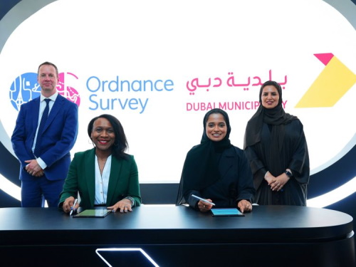
Dubai Municipality, Ordnance Survey Sign Geospatial Agreements

Dubai Municipality, Ordnance Survey Sign Geospatial Agreements

Dubai Municipality has signed two contracts with Ordnance Survey, Great Britain’s national mapping agency, to benefit from global geospatial expertise and support teams working in monitoring activities, buildings permits, survey services, executive planning, and geographic information systems. Paul French, Ordnance Survey chief commercial officer, said: “Dubai Municipality is at an exciting time in expanding its ...
gulfnews.com

بلدية دبي تدشن «محاكاة تخطيط المدينة» لتوفير 40% من الوقت والجهد

كشفت المهندسة ميثاء النعيمي، مدير إدارة مركز نظم المعلومات الجغرافية في بلدية دبي، عن أن مشروع «محاكاة سيناريوهات تخطيط المدينة» في البيئة الإفتراضية، الذي دشنته البلدية ضمن فعاليات «جيتكس 2022» في يومه الأول، من شأنه تقليل الوقت والجهد بنسبة تصل إلى 40%، خاصة أن تخطيط المشاريع كان يجري بواسطة برامج تخصصية يتطلب وقتاً عالياً، إضافة ...
alkhaleej.ae