Geomaticians

UAE

UAE-Made MBZ-SAT Approved For Launch In October

UAE-Made MBZ-SAT Approved For Launch In October

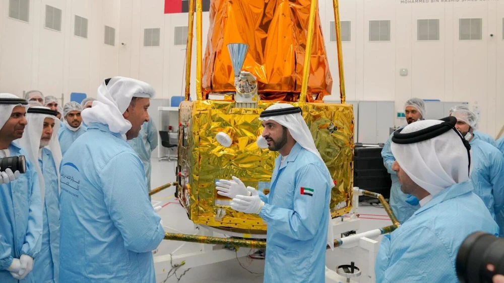
The MBZ-SAT, the most advanced satellite in the region named after the UAE President, has been approved for launch which will take place no earlier than October 2024. The Earth-observation satellite will be launched on a SpaceX rocket further solidifying the UAE’s position in the global space industry. Sheikh Hamdan bin Mohammed, Crown Prince of ...
khaleejtimes.com

The Integrated Transport Centre Signs A MoU With A Leading Japanese Company “Location Mind” In Research And Development

On the sidelines of the 10th session of the Abu Dhabi Japan Economic Council, held in the capital Abu Dhabi, the Integrated Transport Centre (ITC) of the Department of Municipalities and Transport (DMT) in Abu Dhabi signed a strategic Memorandum of Understanding (MoU) with “Location Mind”, a leading Japanese company in the field of research, ...
zawya.com

Abu Dhabi’s Bayanat And Yahsat Merge To Create $4 Billion Space Tech Company

Bayanat, a provider of geospatial data products and services, and Al Yah Satellite Communications, known as Yahsat, are set to merge in a deal that will establish one of the world’s most valuable listed space companies. The combined entity, with a market capitalisation of Dh15 billion ($4.08 billion) based on closing share prices as of ...
edgemiddleeast.com

HCT-Sat 1: UAE Students To Develop Payload For New Earth Observation Satellite

The Mohammed Bin Rashid Space Centre (MBRSC) in collaboration with the Higher Colleges of Technology (HCT) on Tuesday announced the development of HCT-Sat 1, an Earth observation CubeSat. With the payload of the satellite set to be developed by the students of HCT, under the guidance of the Centre’s team, HCT-Sat 1 is expected to ...
gulfnews.com

Rwanda And UAE Sign MoU On Civil Space Activities

UAE and the Rwanda Space Agency have signed a memorandum of understanding with the UAE Space Agency to establish collaboration frameworks in civil space activities, fostering research and development, space technologies, geospatial data sharing, and initiating joint space sector projects. The agreement also offers opportunities for capacity building in space science and technology. This agreement ...
geospatialworld.net

The Federal Geographic Information Center Launches The General Map Of The UAE

As the official reference for geographic information at the federal level and the authoritative body responsible for issuing official maps, the Federal Geographic Information Center proudly announces the launch of the General Map of the United Arab Emirates in both Arabic and English. This milestone symbolizes a commitment to geographical accuracy and national pride. Part ...
zawya.com

IBM Advances Geospatial AI To Address Climate Challenges

IBM today announced new efforts that apply its geospatial AI technologies, including IBM’s geospatial foundation model developed in collaboration with NASA, to climate efforts including analysis of urban heat islands in the United Arab Emirates (UAE); reforestation across Kenya; and climate resiliency in the United Kingdom (UK). IBM continues to advance its AI model strategy ...
newsroom.ibm.com

UAE Launches Development Phase Of Sirb Satellite Programme

The project will enable partnerships with global institutions and offer incentives, as an extension of the Space Economic Zones project. The Sirb programme will enable the commercialisation of satellites and the data they generate on both national and international fronts. This milestone project will include three synthetic aperture radar (SAR) satellites that use advanced imaging ...
gulfbusiness.com
Azercosmos, Bayanat Sign Agreement On Development Of Geographic Information Systems

Azercosmos, Bayanat Sign Agreement On Development Of Geographic Information Systems

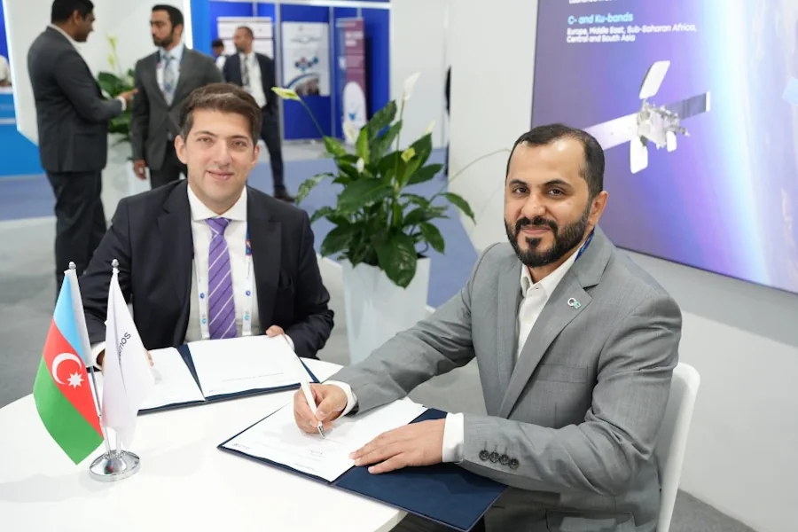
Azercosmos and Bayanat company of the United Arab Emirates (UAE) have signed a cooperation agreement. According to the agreement, the parties will cooperate in the area of Geographic Information Systems (GIS). This includes promoting potential projects and opportunities for the acquisition, processing and application of remote sensing data, geospatial data capabilities, experience and knowledge sharing. ...
azertag.az

Dubai Municipality Launches Digital Platform Empowering Senior Leaders With Customer Requests

Dubai Municipality has launched an innovative ‘Services 360’ policy digital platform, leveraging cutting-edge technologies and Geographic Information System (GIS), to provide its senior leaders and executives with real-time insights into customer requests and communications. This innovative platform empowers executives to oversee the progress of specialised tasks, ensure adherence to the highest service standards, and accelerate ...
wam.ae

Bayanat Partners With HySpecIQ And AzurX To Enable Hyperspectral Imaging And Analysis For The UAE

HySpecIQ, a hyperspectral imaging and data analytics company, today announced a partnership with Bayanat, an ADX-listed public company and provider of AI-powered geospatial solutions. The relationship between HySpecIQ and Bayanat will support the creation of hyperspectral data applications as well as the development of systems that can combine hyperspectral with other geospatial data to produce ...
geospatialworld.net

” المركز الاتحادي للمعلومات الجغرافية ” يطلق “أطلس الاتحاد” الأول من نوعه على مستوى الدولة

أعلن “ المركز الاتحادي للمعلومات الجغرافية ” إطلاق “ أطلس الاتحاد” الأول من نوعه على مستوى الدولة والذي يوفر قاعدة بيانات للمعلومات الجغرافية المكانية والإحصائية الموثوقة بهدف تمكين الجهات الحكومية والخاصة والقطاعات الحيوية في الدولة من تعزيز عملياتها ودعمها في مجال التخطيط المستقبلي، وذلك بما يتماشى مع المستهدفات الوطنية الرامية إلى تحقيق التنمية الشاملة على ...
wam.ae

FGIC Launches The National Geospatial Features Catalogue

The Federal Geographic Information Center (FGIC) announced the launch of the National Geospatial Features Catalogue, which will contribute to the creation of a strategic data guide to facilitate the exchange of geographic information at a national level between federal and local government entities on one side and the private sector on the other. The National ...
zawya.com

Spotnik Launches Smart City Studio Pro

Spotnik Technologies, a Nikai Group company in the UAE, has created an enterprise-grade business support solution that is the latest advancement in productivity and efficiency solutions for smart cities and digital twins. The software toolkit allows users to play with data models, geospatial localizations, and 3D environmental features which will help businesses and governments make ...
zawya.com

Dubai Municipality Launches New Online System For Building Permits Services

Dubai Municipality has announced the launch of a new online system for building permits and control services aimed at streamlining procedures for customers in the emirate. The new system not only complies with the latest BIM standards and geographic information systems, but also facilitates user registration through digital ID and instant recognition. It enables smart ...
zawya.com

Dubai Signs Deal To Enhance Drone Flight Routes

The Dubai Civil Aviation Authority (DCAA) and Dubai Municipality announced the signing of a Memorandum of Understanding (MoU) to collaborate on the Dubai Horizons project. The new initiative focuses on the planning of drone flight routes and landing sites. Over a three-year period, both parties will combine their expertise in generating geospatial data for the ...
itp.net

Bayanat And Yahsat Announce Space Programme To Build Satellite Capabilities

Bayanat, a geospatial data products and services provider, and Abu Dhabi’s Al Yah Satellite Communications, better known as Yahsat, have launched a space programme aimed at building national satellite remote sensing and earth observation (EO) capabilities within the UAE. The space programme will look for business opportunities in the local and global EO market, Bayanat ...
thenationalnews.com
Dewa Launches Its Second Nanosatellite DEWA SAT-2

Dewa Launches Its Second Nanosatellite DEWA SAT-2

Dubai [Abu Dhabi] April 15, (ANI/WAM): Dubai Electricity and Water Authority (DEWA) has successfully launched its second nanosatellite, DEWA SAT-2, aboard SpaceX ‘s Falcon 9 rocket from Vandenberg Space Force Base in California, USA. The launch of DEWA SAT-2 underlines ‘s leadership in using space technologies to improve the operations, maintenance and planning of electricity ...
aninews.in

Abu Dhabi & Singapore Collaborate On Smart City Projects

Companies from Singapore are collaborating with United Arab Emirates (UAE) firms to develop smart city pilot projects in Abu Dhabi. A total of six companies from the Asia-Pacific country, including Mdesign Solutions, Daily Life Renewable Energy, Biodsg and Graymatics, among others, will work on foetus smart city projects while improving security, citizen productivity and municipal ...
geospatialworld.net

Dubai Municipality Launches 3D Infrastructure

H.E. Dawoud Al Hajri, Director General of Dubai Municipality, said: “The project will undertake a comprehensive study on choosing advanced technologies to build a 3D model and an inclusive map of geospatial data on infrastructure and service lines below the ground, integrating all the precise details within a single source of information. The study will ...
mediaoffice.ae

“أوربي” تطلق حلًا متقدمًا لتحويل البيانات الجغرافية إلى فرص لنمو الأعمال

أطلقت “أوربي” (Urbi)، وهي شركة التقنيات الجغرافية الرائدة في الشرق الأوسط، حلها الجديد “أوربي برو” (Urbi Pro) لتجسيد البيانات في تصميم جذاب على الخرائط، الأمر الذي يتيح للشركات إبراز فرص تطوير الأعمال عبر إعدادات التخصيص، مثل إظهار مستوى الطلب في السوق، والمعلومات السكانية، وعدد المنظمات، وغيرها من البيانات، وهو ما سيصب في دعم قرارات العمل ...
arqam.news
بلدية دبي تُعلن عن إطلاق حاضنة الأعمال والابتكار الجيومكانية جيوهب

بلدية دبي تُعلن عن إطلاق حاضنة الأعمال والابتكار الجيومكانية “جيوهب”

أعلنت بلدية دبي عن إطلاق حاضنة الأعمال والابتكار الجيومكانية “جيوهب”، التي تُعدُّ الحاضنة الجيومكانية الرسمية الأولى من نوعها في المنطقة، وذلك في إطار التعاون المشترك بين مركز نظم المعلومات الجغرافية التابع للبلدية، ومؤسسة محمد بن راشد لتنمية المشاريع الصغيرة والمتوسطة، ومركز حمدان للإبداع والابتكار، حيث ترتكز الحاضنة في وتكوينها على منظومتين أساسيتين في الإبداع والابتكار ...
zawya.com
UAE Space Agency Signs MoU With Philippine Space Agency

UAE Space Agency Signs MoU With Philippine Space Agency

The UAE Space Agency has signed a Memorandum of Understanding (MoU) with the Philippine Space Agency (PhiSA) to enhance cooperation in scientific research, space exploration and knowledge exchange to serve common interests and promote international partnerships supporting science and knowledge exchange in the outer space industry, according to the Emirates News Agency. This partnership is ...
spacewatch.global
Dubai Municipality, Ordnance Survey Sign Geospatial Agreements

Dubai Municipality, Ordnance Survey Sign Geospatial Agreements

Dubai Municipality has signed two contracts with Ordnance Survey, Great Britain’s national mapping agency, to benefit from global geospatial expertise and support teams working in monitoring activities, buildings permits, survey services, executive planning, and geographic information systems. Paul French, Ordnance Survey chief commercial officer, said: “Dubai Municipality is at an exciting time in expanding its ...
gulfnews.com
بلدية دبي تدشن «محاكاة تخطيط المدينة» لتوفير 40% من الوقت والجهد

كشفت المهندسة ميثاء النعيمي، مدير إدارة مركز نظم المعلومات الجغرافية في بلدية دبي، عن أن مشروع «محاكاة سيناريوهات تخطيط المدينة» في البيئة الإفتراضية، الذي دشنته البلدية ضمن فعاليات «جيتكس 2022» في يومه الأول، من شأنه تقليل الوقت والجهد بنسبة تصل إلى 40%، خاصة أن تخطيط المشاريع كان يجري بواسطة برامج تخصصية يتطلب وقتاً عالياً، إضافة ...
alkhaleej.ae

UAE Sets Up $816m Fund To Support Space Sector

The UAE Space Agency has announced a new three billion dirhams ($816 million) investment and development fund for the space sector, which will support new programmes in leading edge space sector engineering, sciences and research. The fund’s first investment will be in the development and launch of a constellation of advanced imaging satellites for the ...
gdnonline.com

مركز نظم المعلومات الجغرافية في الفجيرة لـ«الاتحاد»: إنشاء بنية تحتية للبيانات المكانية إلكترونياً

عرض الدكتور أحمد المرشدي مدير مركز نظم المعلومات الجغرافية في إمارة الفجيرة لـ«الاتحاد» أهم المشاريع التي يعمل المركز حالياً عليها، وهي تحديث خريطة الأساس لإمارة الفجيرة وجاري العمل على مشروع إنشاء بنية تحتية للبيانات المكانية بالتعاون مع حكومة الفجيرة الإلكترونية، وبلدية الفجيرة وبلدية دبا ومركز الفجيرة للإحصاء في المرحلة الأولى للمشروع. وقال بأن العمل في ...
alittihad.ae