Geomaticians

Thailand

New GISTDA App Warns Of Hot Spots To Reduce Wildfire Risks

The GISTDA is continuing to develop its application called FAIPA, “Forest Fire” in English, to notify hotspots at the sub-district, district, and provincial levels, using real-time or near real-time satellite data for primary users, including agencies like the Department of Disaster Prevention and Mitigation, volunteer groups, and local residents. The application provides nationwide hotspot data, ...
nationthailand.com
Drones Help Solve The Forest Carbon Capture Riddle In Thailand

Drones Help Solve The Forest Carbon Capture Riddle In Thailand

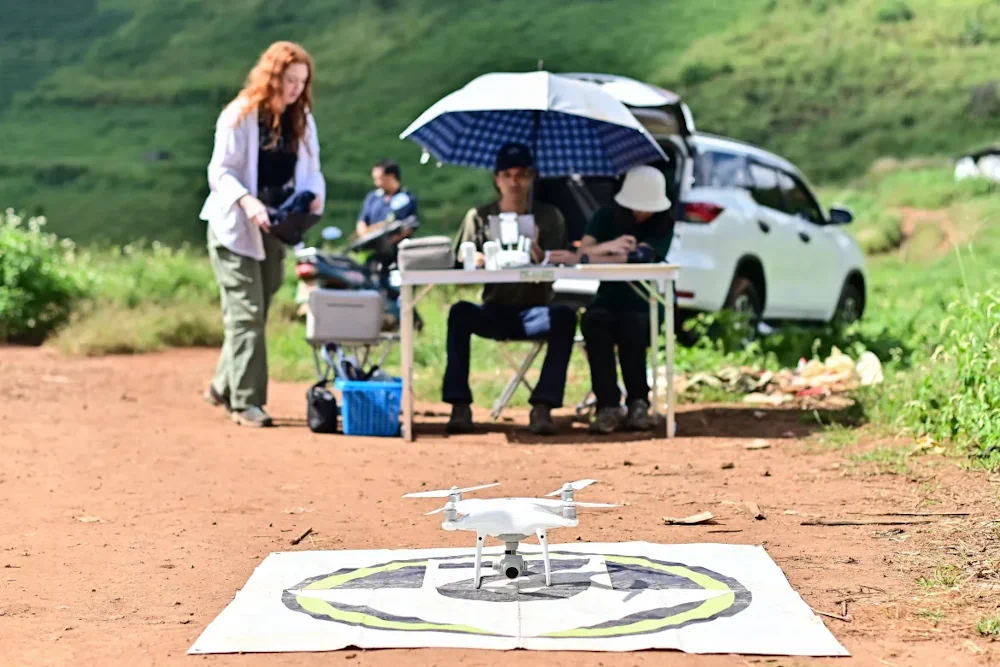
On a hillside overlooking cabbage fields outside the northern Thai city of Chiang Mai, a drone’s rotors begin to whir, lifting it over a patch of forest. It moves back and forth atop the rich canopy, transmitting photos to be knitted into a 3D model that reveals the woodland’s health and helps estimate how much ...
aljazeera.com
THEOS-2 Airbus-built Satellite For Thailand Successfully Launched

THEOS-2 Airbus-built Satellite For Thailand Successfully Launched

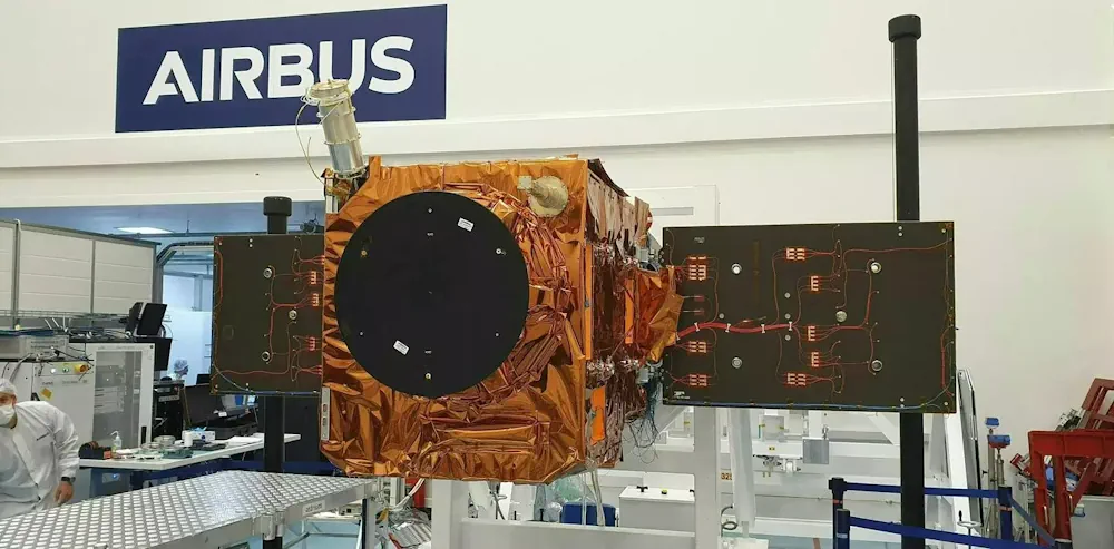
The Airbus-built THEOS-2 Earth observation satellite has been successfully launched on a Vega rocket from Kourou, Europe’s spaceport in French Guiana. The Geo-Informatics and Space Technology Development Agency of Thailand (GISTDA) selected Airbus as partner for its next-generation national geo-information system in 2018. Jean-Marc Nasr, Head of Space Systems at Airbus, said: “This successful launch ...
airbus.com

Thailand Scheduled To Launch Satellite Into Space In October

Thailand has scheduled the Thailand Earth Observation Satellite 2 (Theos-2) satellite, a primary satellite, to launch into space to carry out its mission of earth observation in October. After it was developed and successfully tested, the Theos-2 satellite has been transferred from Airbus Defence and Space in Toulouse, France, to the European spaceport in French ...
borneobulletin.com.bn

Synspective And Thaicom Partner On Disaster Response In Southeast Asia

Imagery startup Synspective and regional operator Thaicom are partnering to jointly offer synthetic aperture radar (SAR) for disaster response in Thailand. The two companies announced Tuesday they plan to offer a solution to government, defense, agriculture, and finance sectors in Thailand, with Synspective’s SAR technology and Thaicom’s knowledge of the satellite and space sector in ...
satellitetoday.com
Study Shows Mountain Forests Being Lost At ‘Alarming Rate,’ Especially In Asia

Study Shows Mountain Forests Being Lost At ‘Alarming Rate,’ Especially In Asia

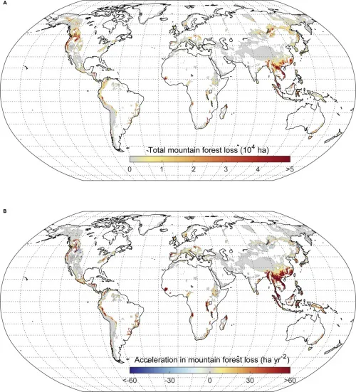
More than 7% of all mountain forests have been destroyed during the past two decades, according to a new study published in the journal One Earth. Using high-resolution satellite data and maps of mountain terrains, researchers found that 780,000 square kilometers (301,000 square miles) of mountain forest were lost worldwide between 2001 and 2018. The ...
news.mongabay.com
FutureTales LAB And ESRI Set Up “Urban Hazard Studio” Data Hub

FutureTales LAB And ESRI Set Up “Urban Hazard Studio” Data Hub

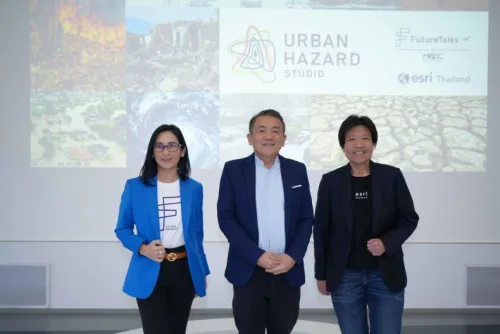
FutureTales LAB by MQDC, a futurology research centre, is collaborating with ESRI (Thailand), a leader in location intelligence and geo-informatics with ArcGIS software, to set up the “Urban Hazard Studio” data hub to study Greater Bangkok’s flood risks. The hub will analyse, evaluate, and share information to alert people and society so all sectors prepare ...
bangkokpost.com

Intermap Announces New Flood Modelling Initiative In Thailand

Intermap Technologies announced the development of a flood modelling initiative and enhanced Digital Elevation Model (DEM) datasets in Thailand. Using a combination of satellite imagery, radar data and ancillary inputs, Intermap will create an extensive, detailed flood map and precision elevation model for the greater Bangkok area. Bangkok itself is sinking due to urban development ...
geospatialworld.net