Geomaticians

Singapore

Singapore Releases 10-Year Geospatial Master Plan

Singapore has launched its new Geospatial Master Plan (2024–33), the second iteration of the island state’s 10-year geospatial strategy. Led by the Singapore Land Authority (SLA) and the Maritime and Port Authority of Singapore (MPA), the Master Plan aims to “enable geospatial-enabled innovations to benefit more segments of society, while addressing the complex challenges Singapore ...
spatialsource.com.au

Registrations Open For Geo Connect Asia 2024

Regional geospatial, positioning and remote sensing conference, Geo Connect Asia, will return to Singapore on the 6th and 7th of March, 2024. The theme, ‘Geospatial driven impacts: underground, ground and sea to sky,’ will address key challenges facing the Asian region, from public health and critical infrastructure to AI and the monitoring of utility operations. ...
spatialsource.com.au
Project Aims To Help Address The Loss Of Cultures Worldwide Caused By Climate Change

Project Aims To Help Address The Loss Of Cultures Worldwide Caused By Climate Change

A team of international researchers, led by Nanyang Technological University, Singapore (NTU Singapore), has announced the initial findings of a project to address the loss of cultures by measuring the impact that climate change has on communities. One finding from the joint project, titled Climate Crisis and Cultural Loss, or 3CL, is the practice of ...
phys.org

Singaporean Alliance Organizes Geospatial-oriented AI Challenge

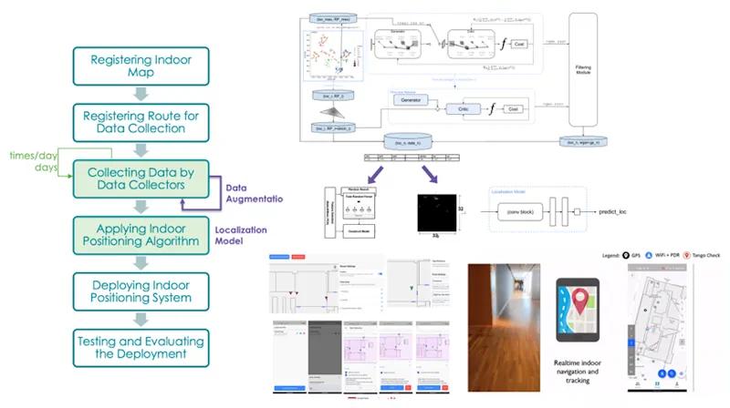
In collaboration with AI Singapore, the Singapore Land Authority (SLA) has launched an innovative challenge centered on visual localization, aimed at addressing how AI can accurately extract camera pose data from 2D images. This is an essential concept in computer vision that refers to the exact position and orientation of a camera in 3D space ...
gim-international.com
Google Partners With Singapore Tourism Board For AI-powered Guided Tours

Google Partners With Singapore Tourism Board For AI-powered Guided Tours

At Google I/O 2023 on Wednesday, Google’s ARCore and the Singapore Tourism Board (STB) launched a preview of two new immersive AR experiences around Merlion Park and Victoria Theatre & Concert Hall in the Visit Singapore app. Powered by Google’s ARCore Geospatial API, visitors will be able to embark on an immersive guided tour. “Google’s ...
ISRO To Launch Singapore’s EO Satellite

ISRO To Launch Singapore’s EO Satellite

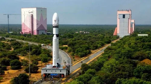
The Indian Space Research Organisation (ISRO) will launch the Singaporean Earth Observation satellite TeLEOS-02 on Saturday, April 22. The launch will take place at 2.19 pm from the first launch pad at Sriharikota. The satellite on board will be TeLEOS 2—a 750kg earth observation satellite that has synthetic aperture radar capable of providing data in ...
geospatialworld.net
Singapore Uses Geospatial Data To Make Roads Greener, Safer, And Easier To Navigate

Singapore Uses Geospatial Data To Make Roads Greener, Safer, And Easier To Navigate

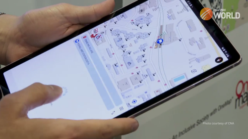
Developed by the Singapore Land Authority, the SLA App provides information that’s not available on normal maps. The map on the platform was designed especially for wheelchair users. The app was demonstrated at the Geo Connect Asia event in Singapore. Developed by the Singapore Land Authority, the SLA App provides information that’s not available on ...
thaipbsworld.com
Geo Connect Asia Returns To Accelerate The Region’s Geospatial And Location Intelligence Capabilities

Geo Connect Asia Returns To Accelerate The Region’s Geospatial And Location Intelligence Capabilities

Geo Connect Asia (GCA), Asia’s leading international geospatial industry event, is returning to Marina Bay Sands Expo & Convention Centre on 15th and 16th March 2023. In its third edition, fuelled by the growing support of a wide range of industry players, GCA 2023 will be held alongside Digital Construction Asia (DCA) 2023, and co-located ...
directionsmag.com

Geospatial Tech For Singapore Forest Carbon Count

The Singapore Land Authority (SLA) and the National University of Singapore (NUS) Faculty of Science have signed an MOU for collaboration on leveraging geospatial data and technologies for carbon estimation research in Singapore. The MOU was signed by Mr Colin Low, Chief Executive of SLA, and Professor Sun Yeneng, Dean of the NUS Faculty of ...
spatialsource.com.au
New Mapping Tool To Support The Search For High-quality Nature-based Carbon Credits

New Mapping Tool To Support The Search For High-quality Nature-based Carbon Credits

An interactive mapping software that will support the prospecting, development and management of nature-based carbon credit projects worldwide was launched on 22 September at the World Economic Forum – Champions for Nature event in New York during Climate Week NYC 2022. The open-access platform (http://carbonprospecting.org), dubbed the Carbon Prospecting Dashboard, was jointly developed by the ...
newswise.com