Geomaticians

Norway

COP28: NICFI And Bezos Earth Fund To Provide Free Satellite Images

Norway’s International Climate and Forest Initiative (NICFI) and the Bezos Earth Fund announce a new partnership to continue providing the world with free access to high-resolution satellite data to support efforts to stop the destruction of the world’s rainforests. The partnership adds to the USD 43 million previously granted by NICFI to establish the NICFI ...
geospatialworld.net
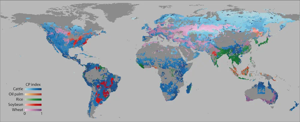
Mapping The Conflict Between Farming And Biodiversity

Mapping The Conflict Between Farming And Biodiversity

Food is one of society’s great moral quandaries. Its production pushes many species to the brink of extinction and the grazing of land that destroys ecosystems. For governments, industry, and communities to effectively balance agricultural needs with environmental needs, however, quantitative information is required. Researchers in Japan, including the Research Institute for Humanity and Nature ...
eurekalert.org
Mapping Hidden Meltwater Paths In Glaciers

Mapping Hidden Meltwater Paths In Glaciers

Norwegian and Estonian researchers have developed a method to map hidden meltwater paths in glaciers. Having a better understanding of how water moves inside and under the glaciers helps to better predict the motion, melting rates, and possible sudden collapses of glaciers. The small floating drifters, about the shape, size, and weight of an average ...
phys.org
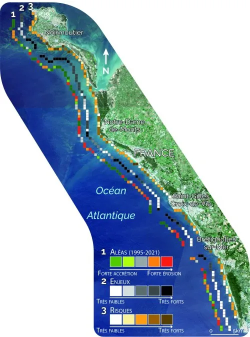
Les Données Satellitaires Au Service De La Gestion Des Littoraux Face Au Changement Climatique Bilan Du Programme Européen ‘ESA Coastal Erosion’ Mené Par I-sea

Les Données Satellitaires Au Service De La Gestion Des Littoraux Face Au Changement Climatique : Bilan Du Programme Européen ‘ESA Coastal Erosion’ Mené Par I-sea

Spécialisée dans la surveillance de la Biodiversité et du Littoral, l’entreprise bordelaise i-Sea est le chef de file de ESA Coastal Erosion, un programme européen de grande envergure initié en 2019 sous l’égide de l’ESA, l’Agence Spatiale Européenne. Basé sur l’observation satellitaire du littoral dans le but de prévenir et lutter contre le recul du ...
cdurable.info
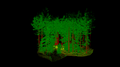
Norway’s Answer To The Smart City Is A “Smart Forest”

Norway’s Answer To The Smart City Is A “Smart Forest”

Norwegian scientists are using mobile lidar to see how individual trees are connected with each other, to help innovate its forest sector and realize efficiency gains. Led by The Norwegian Institute of Bioeconomy Research (NIBIO), the SFI SmartForest aims to bring industry 4.0 to the sector over an 8-year period. Focusing on silviculture, forest operations, ...
geoweeknews.com