Geomaticians

New Zealand

New Wānaka Lake Bed Map To Help Identify Tsunami, Earthquake Risks

New Wānaka Lake Bed Map To Help Identify Tsunami, Earthquake Risks

A new map showing the bed of Lake Wānaka in “incredible detail” will help scientists work out the lake’s potential for earthquakes and tsunami, Niwa says. The work was done after an active fault was found under the lake three years ago. Lake Wānaka is thought to be at risk of a tsunami-like event due ...
stuff.co.nz
Major 'Magnetic Anomaly' Discovered Deep Below New Zealand's Lake Rotorua

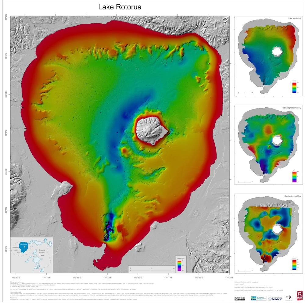
Major ‘Magnetic Anomaly’ Discovered Deep Below New Zealand’s Lake Rotorua

New maps have revealed a hidden hydrothermal system beneath a legendary lake in New Zealand. The Rotorua area is well known for hydrothermal activity, with the Tourism New Zealand website stating that clouds of steam drift around the lake’s shore, and that sulfur gives a “magical green-blue” color to the water. Researchers at GNS Science, ...
livescience.com
Auckland Tsunami Map Refreshed

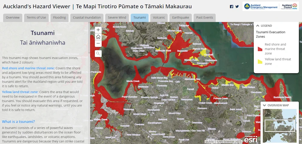
Auckland Tsunami Map Refreshed

Fewer Auckland residents would be at risk in the event of a tsunami than the council previously thought. Auckland Emergency Management (AEM) has updated the region’s tsunami map in the wake of new data which it says showed less of the city’s coastline would be at threat. AEM head of operations John Cranfield said the ...
rnz.co.nz
Restoring Ecosystems To Boost Biodiversity Is An Urgent Priority – Our ‘Eco-index’ Can Guide The Way

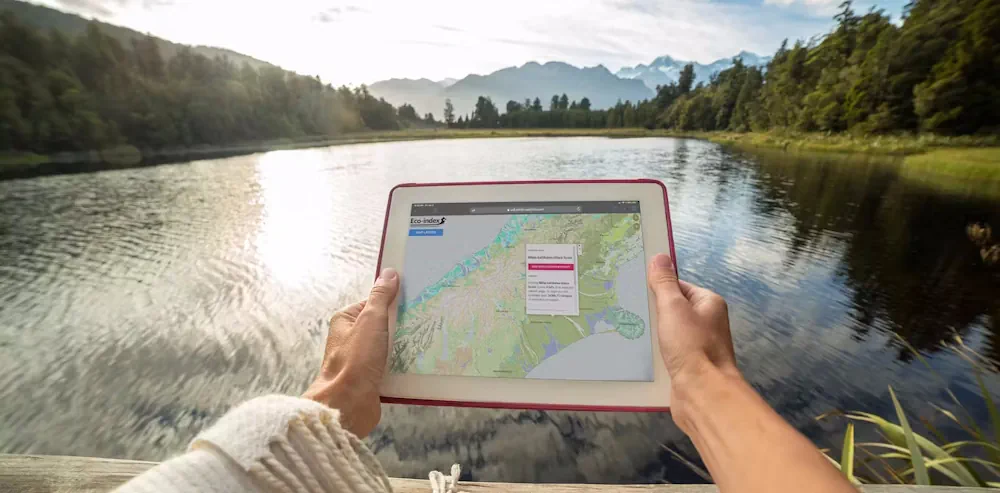
Restoring Ecosystems To Boost Biodiversity Is An Urgent Priority – Our ‘Eco-index’ Can Guide The Way

Biodiversity continues to decline globally, but nowhere is the loss more pronounced than in Aotearoa New Zealand, which has the highest proportion of threatened indigenous species in the world. Planning large-scale biodiversity restoration projects – whether they’re run by NGOs, governments or Indigenous groups – requires high-quality data. Despite the rising demand, however, accessible biodiversity ...
theconversation.com

LINZ Takes New Zealand To The Cloud With 20TB Aerial Data

Land Information New Zealand has made 20TB of aerial imagery available for free for the first time in a cloud-optimized format on Amazon Web Services (AWS), making it easier and faster to access these large datasets over the internet. It includes the latest high-resolution imagery of the New Zealand landscape and imagery flown for emergency ...
gim-international.com

Calling On OEMS To Take Part In Survey To Enhance Precise Positioning Through SouthPAN

The Australian and New Zealand governments, with support from FrontierSI, are conducting a survey with Original Equipment Manufacturers (OEMs) to understand the opportunities and barriers for integrating SouthPAN signal support in your GNSS chips, devices and equipment. SouthPAN is the first Satellite-Based Augmentation System (SBAS) in the Southern Hemisphere and provides improved positioning and navigation ...
insidegnss.com

New Study Finds Gaps In Maternal Immunization Data Sets

A study led by a University of Canterbury geospatial and population health expert has uncovered gaps in nationwide data that tracks maternal immunization rates. The study has been published in the New Zealand Medical Journal. Health Senior Lecturer Dr. Matt Hobbs is also co-director of the GeoHealth Laboratory in the University of Canterbury (UC) Geospatial ...
medicalxpress.com
New Zealand Faces ‘Uninsurable’ Future Unless Planning System Overhauled - Expert

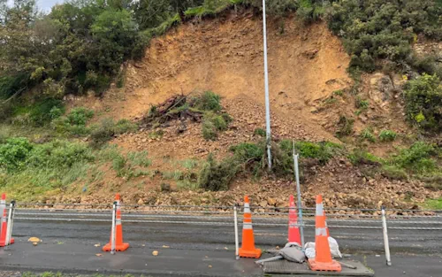
New Zealand Faces ‘Uninsurable’ Future Unless Planning System Overhauled – Expert

An expert on landslides and natural hazards warns much of New Zealand may become “uninsurable” in the future. However, quantifying risk from natural hazards is a fraught business – especially when it comes up against property rights. The storm that triggered a massive slip in Lower Hutt last winter and forced the evacuation of three ...
nzherald.co.nz

Vexcel Announces Free Access To Imagery Data

Vexcel has announced that, through its Vexcel Data Program, it will now provide free access to aerial imagery for government and commercial users in Australia and New Zealand through its web-based platform, Viewer. Announcing the initiative at the Locate23 conference in Adelaide, Ryan Bank, Managing Director of the Geospatial Insurance Consortium (an insurance industry partnership ...
spatialsource.com.au
New 3D Maps Reveal Hundreds Of Ancient Landslides South Of Auckland

New 3D Maps Reveal Hundreds Of Ancient Landslides South Of Auckland

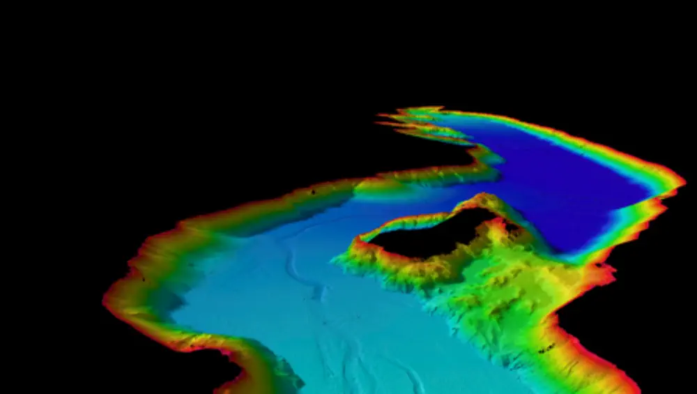
Just-released maps have revealed hundreds of ancient landslides around Pukekohe, while offering a multi-dimensional view of the region’s active faults and volcanic features. Capturing more than 830 square kilometres, from Manukau Harbour’s southern shoreline to the lower Waikato River, the new GNS Science-produced maps show Auckland’s rolling southern landscapes as they’ve never been seen. It ...
nzherald.co.nz
ICSM Publishes Spatial Cadastre Accuracy Standard

ICSM Publishes Spatial Cadastre Accuracy Standard

To increase the confidence in, and usefulness of spatial cadastre data, the Intergovernmental Committee on Surveying and Mapping (ICSM) has produced a Standard for the Accuracy of Spatial Cadastres in Australia and New Zealand, along with a Supporting Document. The Standard establishes targets and a reporting framework for acceptable Positional Uncertainty (PU) for the horizontal ...
spatialsource.com.au
Kea Aerospace Debuts Solar-powered Stratospheric UAS With Audi EV Technology

Kea Aerospace Debuts Solar-powered Stratospheric UAS With Audi EV Technology

The New Zealand-based company Kea Aerospace has developed an innovative solar-powered stratospheric aircraft, called the Kea Atmos Mk 1, which is designed for high-altitude flight testing. The aircraft has a wingspan of 12.5 meters and weighs under 40 kilograms, making it lightweight enough to fly at altitudes higher than commercial airliners, up to 50,000 feet. ...
uasweekly.com
Trimble Opens First Trimble Technology Lab In New Zealand At The University Of Auckland

Trimble Opens First Trimble Technology Lab In New Zealand At The University Of Auckland

Trimble and the University of Auckland announced the opening of the first Trimble Technology Lab in New Zealand. The lab builds upon the university’s leadership in training and research in engineering and construction-related disciplines. The University of Auckland joins a network of nearly 30 universities around the world with Trimble Technology Labs. The Trimble Technology ...
prnewswire.com

Mapping The Risks Of Isolation Due To Sea Level Rise Associated With Global Warming

A trio of environmental engineers, two with the University of Canterbury in New Zealand, the third with the University of Maryland, has developed a way to illustrate the impact of sea level rise isolation associated with global warming. In their paper published in Nature Climate Change, Tom Logan, M. J. Anderson and Allison Reilly describe ...
phys.org

High-resolution Mapping Of Otago’s Entire Coastline Completed

A new high-resolution ground mapping dataset of Otago’s entire coastline is complete – now including about 30-40 kilometres inland – covering a total 4250 square kilometres of land. The high-resolution 3D ground elevation data for the coastline and its catchments is now available online via the LINZ Data Service and Open Topo web sites, says ...
scoop.co.nz
New Satellite-based Augmentation System For Australia And New Zealand

New Satellite-based Augmentation System For Australia And New Zealand

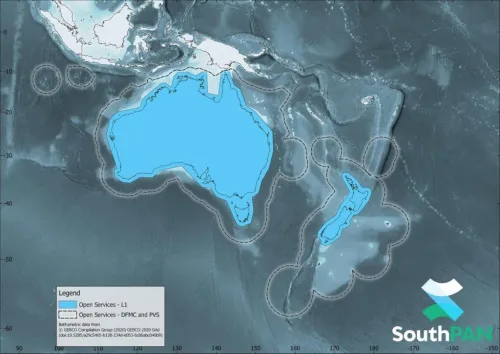
AMSA informed that vessels navigating in Australian and New Zealand waters can now access a Satellite-Based Augmentation System (SBAS) called SouthPAN. SouthPAN provides accurate, reliable and instant augmentation of PNT information across all of Australia and New Zealand. For example, the horizontal accuracy provided is several times better than the current unaugmented GNSS accuracy of ...
safety4sea.com
Lidar Survey Of New Zealand’s Taranaki Regio

Lidar Survey Of New Zealand’s Taranaki Region

A ground-breaking aerial LiDAR survey of Taranaki’s land surface has just been completed, opening up a wealth of valuable land-surface and elevation data for a wide range of uses. The dataset — collected in 2021 and two years in the making — will be used to generate high-definition 3D maps and models for environmental management ...
spatialsource.com.au
NASA Earth Science Racks Up Frequent-flier Miles In New Zealand Skies

NASA Earth Science Racks Up Frequent-flier Miles In New Zealand Skies

Since mid-September 2022, NASA-funded instruments have been hitching rides on commercial aircraft and collecting environmental data over New Zealand. The collaboration with Air New Zealand is the first known data-collecting partnership between a passenger airline and a NASA Earth science mission. The new program is part of NASA’s Cyclone Global Navigation Satellite System (CYGNSS) mission, ...
phys.org

NIWA Uses Satellite Images To Track Health Of New Zealand’s Coastal Waters

For the first time, NIWA has used satellite images to monitor the health of coastal waters around Aotearoa by tracking levels of suspended sediment in those waters. Satellite data has already been used to monitor algal blooms, oil spills and water temperature, NIWA said. Now, NIWA has analysed images from NASA’s Aqua MODIS satellite which ...
rnz.co.nz

Synspective’s Third SAR Satellite “Strix-1” Successfully Reaches Target Orbit

Synspective Inc., a SAR satellite data and solutions provider, announced today that StriX-1, its third SAR satellite, has successfully been put into its target orbit. On September 16 (JST), StriX-1 was deployed by Rocket Lab’s Electron at Rocket Lab Launch Complex 1 on New Zealand’s Mahia Peninsula. The satellite was put into its target orbit: ...
geospatialworld.net