Geomaticians

Malta

Esri To Provide Malta Agencies With GIS Solutions

The Malta Information Technology Agency (MITA) has signed an enterprise agreement with Esri to enhance its GIS capabilities. The three-year agreement will provide Esri software, professional services and technical support to MITA and 22 other agencies across the Maltese government. Agencies such as health, communications and infrastructure organisations that do not currently benefit from enterprise ...
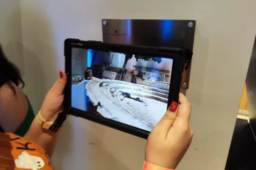
Augmented Reality Tech Shows Children How Crime Scene Investigation Works

Augmented Reality Tech Shows Children How Crime Scene Investigation Works

Using Ipad Tablets as their virtual eyes, children can explore a mockup crime scene by walking around a designated area within the science museum at a booth set up by the Malta Police Force’s forensics department. The Ipads uses Augmented Reality technology to display the mock crime scene, essentially overlaying information over the real-world environment ...
timesofmalta.com
Observing The Maltese Islands Using Satellites

Observing The Maltese Islands Using Satellites

The University of Malta is currently leading two research projects which make use of EO data and which have a national relevance. The first project, ‘Coastal Satellite Assisted Governance (tools, techniques, models) for Erosion’ (Coastal SAGE), tackles the unrelenting phenomenon of coastal erosion, which is of importance to the Maltese islands as the coast is ...
timesofmalta.com