Geomaticians

India

ISRO Working To Expand Navigation System NaVIC Coverage To 3,000 Km From 1,500 Km Beyond India

Isro is working on increasing the coverage of its Indian Regional Navigation Satellite System or NaVIC to 3,000 km from the existing 1,500 km (from beyond the Indian boundary), Isro chairman S Somanath informed on Tuesday. During the CSIR Foundation Day event at Bharat Mandapam, Somanath gave a presentation of the space agency’s activities where ...
timesofindia.indiatimes.com

AWS Ties Up With ISRO And IN-SPACe To Advance India’s Space Capabilities With Cloud Technologies

Amazon Web Services (AWS) India Private Limited has signed a strategic Memorandum of Understanding with the Indian Space Research Organization (ISRO) and Indian National Space Promotion and Authorization Centre (IN-SPACe) to support space-tech innovations through cloud computing. This collaboration will give space startups, research institutes and students access to cutting edge cloud technologies that accelerate ...
aboutamazon.in

Compulsory For UP Developers To Tag Projects With GIS-based Master Plans

The Uttar Pradesh Real Estate Regulatory Authority (UP RERA) will soon make it mandatory for developers to tag the maps of their projects with the Geographic Information System (GIS)-based master plans in 13 major cities across the state. This move is meant to check whether the upcoming project is on a bona fide site as ...
daijiworld.com

CS Launches Online Statistical Data Collection Applications

Chief Secretary of Nagaland, J. Alam, has unveiled two significant online statistical data collection applications developed by the Directorate of Economics & Statistics, Nagaland. The launching programme was held on August 22 at the Chief Secretary’s Conference Hall in Kohima. According to a DIPR report, the first application is the Village Level Development Indicators (VLDI), ...
nagalandpost.com
Geospatial AI And ML To Revolutionise Air Quality Monitoring In Indian Cities

Geospatial AI And ML To Revolutionise Air Quality Monitoring In Indian Cities

Geospatial artificial intelligence (AI) and machine learning models are set to transform the monitoring of air quality in major Indian cities, including Delhi, Mumbai, Bengaluru, Chennai, and Kolkata. This groundbreaking development was announced by a senior scientist during the India Clean Air Summit (ICAS) 2023. “We must link up SDGs and air pollution indicators, as ...
theweek.in

Khanan Prahari App Helping To Curb Illegal Coal Mining Activities Through Public Participation

The mobile app Khanan Prahari, which allows citizens to report incidents of illegal coal mining through geo-tagged photographs and textual information, is a significant step taken by the Ministry of Coal towards curbing illegal coal mining activities. The corresponding web portal called as Coal Mine Surveillance & Management System (CMSMS) has been developed in association ...
indiaeducationdiary.in

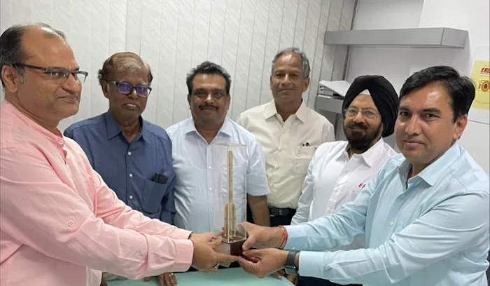
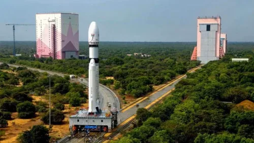
India-Omani Earth Observation Platform Inaugurated

In a cooperation initiative between the Ministry of Transport, Communications and Information Technology and the Indian Space Research Organization, His Excellency Engineer Saeed bin Hamoud Al Maawali, Minister of Transport, Communications and Information Technology, inaugurated the India-Omani Earth Observation Platform. With the aim of learning about the Indian experience in the field of space, His ...
timesofoman.com

IN-SPACe May Be Looking At 130 Satellites, But Need More Than That: Experts

Is the Indian government looking at having about 130 earth observation satellites under the public-private-partnership model, an idea mooted by the Indian National Space Promotion and Authorisation Centre (IN-SPACe) in its consultation paper? It seems yes, based on the kind of imagery that is required and the number of revisits a satellite has to make ...
nagalandpost.com

3 Indian Space Startups To Launch Satellites In FY24: In-space

Three private sector satellite makers are expected to send their earth observation satellites this fiscal, according to the sectoral regulator Indian National Space Promotion and Authorisation Centre (IN-SPACe). The three companies are the Chennai-based GalaxEye Space Solutions Pvt Ltd, Hyderabad-based Dhruva Space and the Bengaluru-based Pixxel. GalaxEye’s first satellite Dhrishti is expected to launch in ...
hindupost.in

Govt To Undertake GIS Mapping Of Urban Areas

In order to plug revenue leakages, the state government will conduct a geographic information system (GIS) mapping of all properties in municipal areas in the state, Urban Development Minister Vishwajit Rane informed the Goa legislative assembly on Thursday. Rane said the work of GIS mapping has already started in North Goa and the tender process ...
navhindtimes.in

City Police Geotagging 23,000-plus Surveillance Cameras In Coimbatore

Feeds from surveillance cameras play a key role in tracing and identifying individuals and vehicles during investigations. But locating cameras in a given location after the occurrence of a crime or accident often causes delay in the investigation. Now, the Coimbatore City Police are in the process of cutting down this delay by geotagging all ...
thehindu.com

Nagaland: WRI India Launches Energy Access Explorer In State For Unserved And Underserved Communities

After Jharkhand and Assam, the World Resources Institute (WRI) India launched its flagship geospatial platform, energy access explorer or EAE, for Nagaland in Kohima on July 28. A WRI India official told this correspondent EAE is a geospatial platform that provides data on electricity, health, education and livelihood indicators in the regions that it serves ...
indiatodayne.in
Giant ‘Gravity Hole’ In The Ocean May Be The Ghost Of An Ancient Sea

Giant ‘Gravity Hole’ In The Ocean May Be The Ghost Of An Ancient Sea

There’s a massive “hole” in the Indian Ocean, researchers say—but it’s not the kind that could drain away all that water. Instead it’s a term geologists use to describe a spot where Earth’s gravity is lower than average. And a new study may have finally revealed its origins: it appears to be caused by plumes ...
scientificamerican.com

Agriculture Ministry Signs MoU With Pixxel Space To Develop Geospatial Solutions

The Union Agriculture Ministry has signed an MoU with Pixxel Space India Pvt. Ltd., to develop various geospatial solutions, mainly for monitoring the health of crops and soil. The Memorandum of Understanding was signed on Monday in the presence of Agriculture Secretary Manoj Ahuja. Mahalanobis National Crop Forecast Centre on behalf of the ministry will ...
bqprime.com
Policing In Chennai Goes Hi-Tech With GIS Mapping, Analytics Of Crime Zones

Policing In Chennai Goes Hi-Tech With GIS Mapping, Analytics Of Crime Zones

The Greater Chennai Police (GCP) on Tuesday launched mapping of crime zones using Geographic Information System (GIS). Commissioner of Police Shankar Jiwal inaugurated the new initiative at the integrated command and control centre. A special GIS centre has been established and equipped with the latest software tools to collate data from Crime and Criminal Tracking ...
thehindu.com
U.S. And India To Expand Spaceflight Cooperation

U.S. And India To Expand Spaceflight Cooperation

The governments of the United States and India have agreed to work more closely together in spaceflight, with India signing the Artemis Accords and the two countries planning for a joint mission of some kind to the International Space Station. In a fact sheet distributed by the White House, the governments said they agreed that ...
spacenews.com

Ex-ISRO Official Promoted Sisir Radar Test Flew Drone Fitted With ‘Rabbit SAR’

Space sector startup, Sisir Radar Private Ltd has successfully tested its Synthetic Aperture Radar (SAR) fitted on a drone, said a senior company official. “The drone fitted with SAR was flown (on Friday) at a place called Sonarpur, about 50 km from Kolkata,” Tapan Misra, Founding Director and Chief Scientist, Sisir Radar Private Ltd, told. ...
dtnext.in
Erisha Space Plans To Launch Satellite In 2024

Erisha Space Plans To Launch Satellite In 2024

Erisha Space Pvt Ltd, a Delhi-based solutions and service provider in the field of remote sensing, GIS, and photogrammetry, said it would launch a satellite equipped with advanced image processing capabilities and machine learning/artificial intelligence frameworks in 2024. The company said the satellite will further enhance its capabilities and enable the provision of comprehensive solutions ...
theweek.in

Indian Space Startup’s Azista BST’s Satellite Orbited By SpaceX’s Falcon 9 Rocket

Indian space sector startup Azista BST Aerospace Pvt Ltd`s first remote sensing satellite ABA First Runner (AFR) was successfully orbited by SpaceX`s Falcon 9 rocket. According to SpaceX, the rocket on a dedicated rideshare mission carried 72 spacecraft that includes CubeSats, MicroSats and others and one of them was the Ahmedabad-based Azista BST Aerospace`s 80 ...
zeebiz.com

GSI To Carry Remote Sensing In Bihar To Identify Magnetite-bearing Rocks

The Bihar government has decided to sign an MoU with Geological Survey of India for conducting remote sensing and aerial survey of the southern part of the state to identify magnetic anomaly on the surface representing the presence of rocks having a higher content of ferrous and ferromagnesian minerals, an official said. For the first ...
business-standard.com

‘India Conducts Asia’s First Demo Of Performance-based Navigation For Copters’

India conducted Asia’s first demonstration of performance-based navigation for helicopters for a flight from Juhu in Mumbai to Pune using GAGAN satellite technology, civil aviation minister Jyotiraditya Scindia said on Wednesday. GAGAN — GPS Aided GEO Augmented Navigation — is a state-of-the-art space-based augmentation system which adds more accuracy to output of GPS Navigation system ...

Delhi To Have AI-based Traffic System By 2024-end: Official

The national capital will have an artificial intelligence-based traffic system by the end of next year to reduce congestion and facilitate faster and smarter vehicular movement, a senior official said on Wednesday. Speaking at ASSOCHAM seventh road safety conference here, Special Commissioner of Police (Traffic) Surender Singh Yadav mentioned that the Intelligent Traffic Management System ...
devdiscourse.com

Esri India And ideaForge Join Hands

Esri India, the country’s leading Geographic Information System (GIS) Software & Solutions provider announced the signing of a Memorandum of Understanding (MOU) with ideaForge, a market leader in the Indian Unmanned Aircraft Systems. The objective of this partnership is to boost the adoption of drones in India. The partnership between Esri India and ideaForge will ...
timestech.in

Raj Govt Approves Proposal To Create GIS-based 3D Models Of 4 Cities

Rajasthan government has approved a proposal for developing Geographic Information System (GIS) based 3D models of Jodhpur, Udaipur, Kota and Ajmer. According to an official statement, the state government will develop GIS-based 3D models of the four cities for better planning and management of urban development. Apart from this, a ‘repository’ of satellite imagery of ...
devdiscourse.com

ISRO To Launch New Navigation Satellite On May 29

Five years after launching the last navigation satellite in 2018, ISRO is gearing up to launch a new one on May 29 from Sriharikota to replace an old satellite. The aim is to maintain a constellation of functional seven satellites needed to keep its navigation system operational and running. Confirming the launch, a senior Isro ...
timesofindia.indiatimes.com
Indo-American Chamber Of Commerce Signs MoU With Geospatial World Chamber Of Commerce

Indo-American Chamber Of Commerce Signs MoU With Geospatial World Chamber Of Commerce

A Memorandum of Understanding (MoU) was signed between Indo-American Chamber of Commerce, India (IACC) and Geospatial World Chamber of Commerce(GWCC). Dr Lalit Bhasin, National President of IACC and Sanjay Kumar, CEO of GWCC officially signed the MoU with the purpose of establishing a framework for collaboration in Building Mutual Cooperation and Bilateral Trade Relations between ...
geospatialworld.net

Scientists From Country’s Top Space Research Institutes Join Climate Change Deliberations At Kashmir University

Distinguished scientists from the country’s top research organisations involved in satellite earth observation including ISRO and other institutions of national importance joined deliberations on the use of satellite earth observation for climate services during a national-level workshop on ‘Earth Observations for Climate Services’ at the University of Kashmir on Thursday. Vice-Chancellor Prof Nilofer Khan inaugurated ...
greaterkashmir.com

Chandigarh To Implement Integrated Property Management System

In line with the achieving long-term objective of a ward index the UT administration has initiated implementation of complete map-based enterprise solution to cater to the need of property data for departments like the Municipal Corporation, estate office and Chandigarh Housing Board (CHB). Under the project implemented by the IT department a solution is being ...
rprealtyplus.com

India’s Space Policy Draft Document Released

The draft of the recently released India’s Space policy is out. The document is forward-looking and aims at creating an innovative private space ecosystem along with delineating the roles and responsibilities of InSpace and NSIL. Last week, when the space policy was finalized Union Minister, Jitendra Singh said, “In brief, the Indian Space Policy will ...
geospatialworld.net
ISRO To Launch Singapore’s EO Satellite

ISRO To Launch Singapore’s EO Satellite

The Indian Space Research Organisation (ISRO) will launch the Singaporean Earth Observation satellite TeLEOS-02 on Saturday, April 22. The launch will take place at 2.19 pm from the first launch pad at Sriharikota. The satellite on board will be TeLEOS 2—a 750kg earth observation satellite that has synthetic aperture radar capable of providing data in ...
geospatialworld.net