Geomaticians

China

Mapping Street-level Pollution Estimates To Reveal Safer Routes

Mapping Street-level Pollution Estimates To Reveal Safer Routes

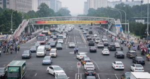
The United Nations has identified improving the walkability and bikeability of cities as a key goal in efforts to reduce dependence on greenhouse gas–emitting automobiles and promote routine exercise for public health. However, increased walking and cycling can come with their own health risks. Time spent in the open air, in addition to other factors, ...
phys.org

China Deploys Teledyne Product For Post Disaster Recovery Efforts

Teledyne Geospatial announced that the State Key Laboratory of Geohazard Prevention and Geoenvironment Protection in China’s Sichuan province recently deployed the Optech Galaxy T2000 to aid in the post disaster recovery and reconstruction phase after a 6.8 magnitude earthquake caused heavy damage to buildings, roads and other infrastructure in the Luding area. Eight days after ...
geospatialworld.net

MoU Signed To Protect Global Heritage With Space Technology

The International Centre on Space Technologies for Natural and Cultural Heritage (HIST) under the auspices of UNESCO and the International Council on Monuments and Sites (ICOMOS) signed a Memorandum of Understanding (MoU) on Monday to promote world heritage conservation with space technology. With heritages facing risks from natural disasters, climate change, and other dangers, space ...
china.org.cn
China Launches Yaogan-34 Remote-sensing Satellite For Land Surveys, Disaster Prevention

China Launches Yaogan-34 Remote-sensing Satellite For Land Surveys, Disaster Prevention

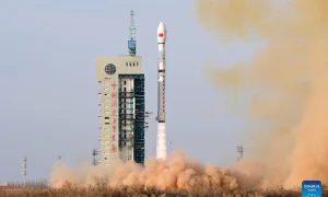
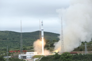
China sent a new remote-sensing satellite of the Yaogan-34 series into space from the Jiuquan Satellite Launch Center in northwest China on Tuesday morning, marking the launch of the100th satellite developed by the 509th Research Institute of the Shanghai Academy of Spaceflight Technology. It will mainly be used in land resources surveys and disaster prevention. ...
globaltimes.cn

Chinese Firm Plans To Develop Commercial Remote Sensing Satellite System

The China Siwei Surveying and Mapping Technology will build its new-generation commercial remote sensing satellite system by 2025, the Science and Technology Daily reported Thursday. Zhang Xiaodong, general manager of the company, made the remarks at the ongoing 14th China International Aviation and Aerospace Exhibition, also known as Airshow China, in the southern port city ...
english.news.cn
China’s Beidou Satellite Navigation System Gets A Stronger Foothold In The West

China’s Beidou Satellite Navigation System Gets A Stronger Foothold In The West

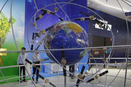
Far above our planet, China’s growing constellation of navigation satellites is offering more precision than ever, thanks to some down-to-earth support in North America. At least two ground monitoring stations for the Beidou satellite navigation system are now operating on the continent, one of which is located somewhere in the central United States, according to ...
scmp.com

Baidu Secures Approval To Deploy HD Maps For Driver Assistance Systems

Baidu said on Monday that it has received permission from regional authorities in the southern Chinese cities of Shenzhen and Guangzhou to provide automakers with its high-definition mapping technology to enable advanced driver assistance systems (ADAS) on production vehicles. The company claimed that its lane-level HD map and in-car software would allow vehicles to change ...
technode.com

Digital Solutions Help Rural Pakistan

As flash floods recede in Pakistan, the country welcomes the first smart IoT (Internet of Things) farm in Rawalpindi. Satellite navigation autopilot, robotic fertiliser applicator, agricultural UAV, climate and soil monitoring stations, solar-powered water pump…the deluge-ravaged land is recovering by virtue of digital solutions. “This is just a beginning,” Liu Yang Sloan, Secretary General of ...
tribune.com.pk
China Successfully Launches New Remote Sensing Satellite

China Successfully Launches New Remote Sensing Satellite

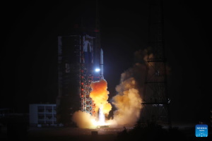
China sent a new remote sensing satellite into space from the Xichang Satellite Launch Center in the southwestern province of Sichuan on Monday. The satellite, Yaogan-36, was launched by a Long March-2D carrier rocket at 9:38 p.m. (Beijing Time) and has entered the planned orbit successfully. This was the 439th flight mission of the Long ...
english.news.cn

China’s Beidou-compatible Smartphone Shipments Exceed 130 Mln In H1

The applications of satellite navigation and positioning services in China have seen steady growth in the first half of 2022, with shipments of smartphones supporting the BeiDou Navigation Satellite System (BDS) exceeding 130 million, according to a BDS applications conference that opened here Wednesday. In the first half of this year, the overall revenue and ...
english.news.cn

China Launches New Satellites For Scientific Experiments

China launched a group of three Yaogan-35 05 satellites atop a Long March-2D carrier rocket at 12:19 p.m. Beijing Time from the Xichang Satellite Launch Center in southwest China’s Sichuan Province on Tuesday, according to China Aerospace Science and Technology Corporation. The remote sensing satellites entered preset orbit, which signaled the launch was a success. ...
news.cgtn.com
China Automakers must be licensed to collect, track geographic data in smart vehicles

China: Automakers must be licensed to collect, track geographic data in smart vehicles

China has mentioned that automakers should apply for licences to gather geographic information utilizing sensors on clever automobiles, highlighting Beijing’s safety considerations in regards to the rising sophistication of good automobiles’ mapping capabilities. The assertion, a clarification of China’s surveying and mapping legislation, displays regulators efforts to forestall any situation the place highly-detailed visible information ...
autorecent.com

China Supports Pakistan In Geomatics Technology Upgrading

The Advanced Seminar on Geomatics Technology for Pakistan sponsored by the Ministry of Commerce of China is ongoing online to help improve Pakistani scientists and officers’ expertise in geomatics. It’s learned that a total of 19 Pakistani experts and officers from the Society of Engineering, National Institute of Computer Sciences, University of AJ & K ...
en.ce.cn
China Launches 16 Commercial Remote Sensing And Weather Satellites

China Launches 16 Commercial Remote Sensing And Weather Satellites

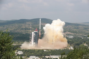
China has carried out its ninth orbital mission within the last 30 days, sending 16 new commercial satellites into orbit with a Long March 6 rocket. The Long March 6 rocket lifted off from Taiyuan, north China, on Wednesday (Aug. 10) at 12:50 a.m. EDT (0450 GMT, 12:50 p.m. local time), the China Aerospace Science ...
space.com
China Launches Terrestrial Ecosystem Carbon Monitoring Satellite

China Launches Terrestrial Ecosystem Carbon Monitoring Satellite

China successfully launched a terrestrial ecosystem carbon monitoring satellite and two other satellites from the Taiyuan Satellite Launch Center in north China’s Shanxi Province Thursday. The satellites were launched at 11:08 a.m. (Beijing Time) by a Long March-4B carrier rocket and entered the planned orbit successfully. The carbon monitoring satellite is mainly used for terrestrial ...
english.news.cn

China Launches New Group Of Remote Sensing Satellites

China successfully launched a new group of remote sensing satellites from the Xichang Satellite Launch Center in southwest China’s Sichuan Province Friday. The satellites were launched as the third group of the Yaogan-35 family at 9:28 p.m. (Beijing Time) by a Long March-2D carrier rocket and entered the planned orbit successfully. The satellites will be ...
ecns.cn
Baidu Unveils Next-Gen Driverless Robotaxi

Baidu Unveils Next-Gen Driverless Robotaxi

Baidu, Inc., a leading AI company with strong internet foundation, today unveiled its next-generation fully autonomous vehicle (AV) Apollo RT6, an all-electric, production-ready model with a detachable steering wheel. Designed for complex urban environments, Apollo RT6 will be put into operation in China in 2023 on Apollo Go, Baidu’s autonomous ride-hailing service. With a per ...
geospatialworld.net
Beidou Makes Farming More Efficient

Beidou Makes Farming More Efficient

One of the technologies that back up the smart facilities is the Beidou Navigation Satellite System, China’s homegrown system known for its high-precision positioning service. At a farm in Pingyuan county, Shandong province, farmers at Pingyuan Luwang Agricultural Development Co have been using tractors equipped with the Beidou system to plant soybeans between rows of ...
china.org.cn