Geomaticians

Hong Kong

Researchers Propose New Method for Large-Scale Urban Building Function Mapping Using Web-Based Geospatial Data

Researchers Propose New Method for Large-Scale Urban Building Function Mapping Using Web-Based Geospatial Data

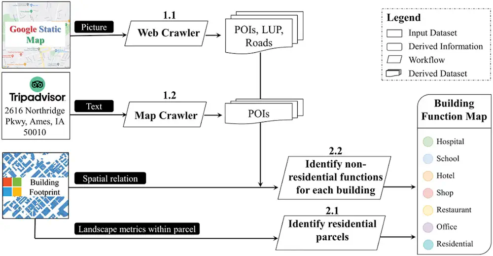
In a pioneering study published in Geo-spatial Information Science, a research group led by Yuyu Zhou from The University of Hong Kong developed an integrated framework that achieves 94% accuracy in mapping building functions across 50 U.S. cities using multi-source web-based geospatial data, offering potential for worldwide application. The team utilized TripAdvisor.com and Google Maps ...
newswise.com
Hong Kong's First-ever And One Of The World's Largest Satellite Manufacturing Facilities To Deliver First Satellite By 2024

Hong Kong’s First-ever And One Of The World’s Largest Satellite Manufacturing Facilities To Deliver First Satellite By 2024

China’s Hong Kong Special Administrative Region (HKSAR) has newly launched the city’s first and one of the world’s largest satellite manufacturing facilities, known as AMC. The facility revealed to the Global Times in an exclusive interview that their first made-in-Hong Kong, high-quality satellite would hopefully be delivered by the beginning of 2024. Referred also as ...
globaltimes.cn
Mapping Street-level Pollution Estimates To Reveal Safer Routes

Mapping Street-level Pollution Estimates To Reveal Safer Routes

The United Nations has identified improving the walkability and bikeability of cities as a key goal in efforts to reduce dependence on greenhouse gasā€“emitting automobiles and promote routine exercise for public health. However, increased walking and cycling can come with their own health risks. Time spent in the open air, in addition to other factors, ...
phys.org