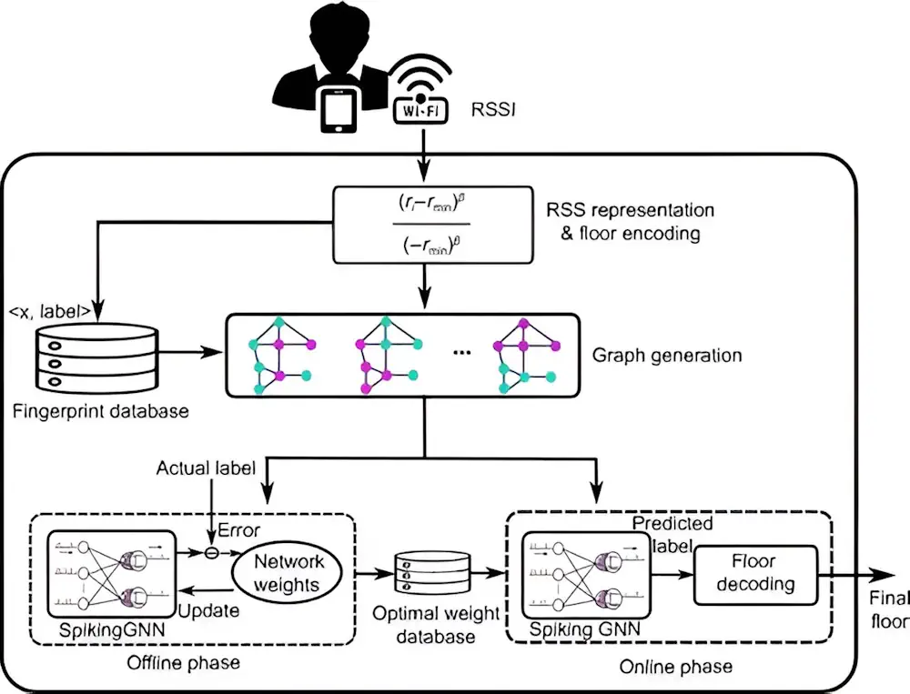
Introducing Floorlocator, A System That Enhances Indoor Navigation
Indoor positioning is transforming with applications demanding precise location tracking. Traditional methods, including fingerprinting and sensor-based techniques, though widely used, face significant drawbacks, such as the need for extensive training data, poor scalability, and reliance on additional sensor information. Recent advancements have sought to leverage deep learning, yet issues such as low scalability and high ...
techxplore.com