Google Maps has become an invaluable tool to navigate and to find the best spots to eat, get coffee, or to see sights. But with some bigger buildings and attractions, it can get hard to find the entrance. That’s where a new experiment comes in that Google appears to be testing with a few users and buildings, with an icon indicating where to exit and enter a place when it’s selected.
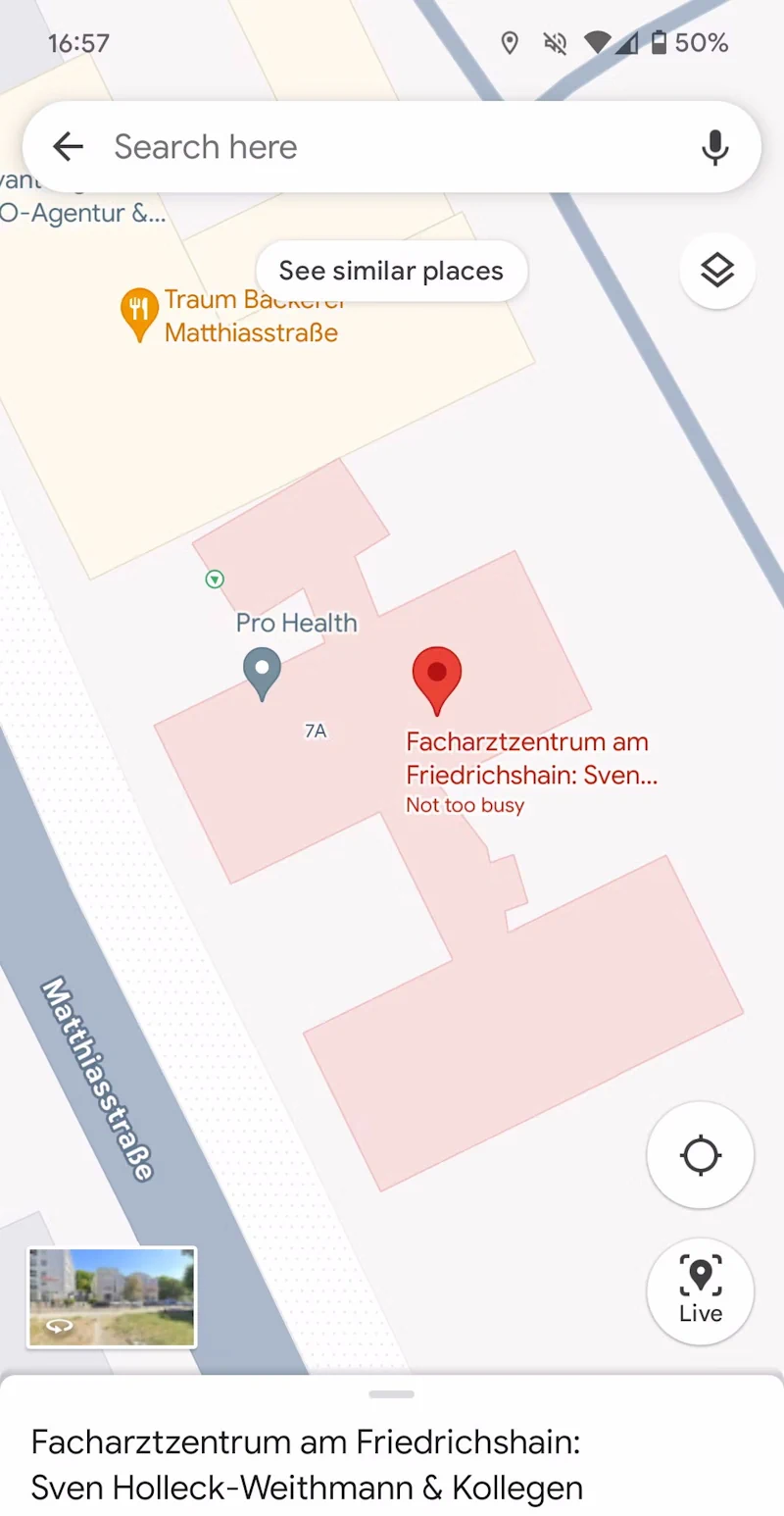
In our testing, we can confirm the experiment on Google Maps version 11.17.0101 on a Google Pixel 7a. On our device, entrances only show up when a place is selected on the map and when it’s sufficiently zoomed in. They are depicted as round, white circles with an entry symbol in them. We couldn’t get this information to show up on other devices with Google Maps updated to the latest release across different countries and continents, so it seems like this is currently a very limited test run. We’ve also noticed that in contrast to other phones, selected businesses or buildings turn red, making it easier to differentiate them from surrounding places.
We experimented with a few different kinds of buildings, ranging from hotels, doctors’ offices, supermarkets, hardware stores, cafes, and restaurants in New York City, Las Vegas, and San Francisco as well as in Berlin, Germany. The entrances showed up for some of the places but not for others, indicating that Google may still be in the process of collecting the necessary information. For some places, we were also able to confirm that the entrances aren’t shown in the right spot, though that seems to be a bigger problem the smaller the building in question is, where the exact position doesn’t matter as much.
In some instances, entrances are also depicted with a simpler green arrow in a white circle, though we haven’t been able to work out when Maps decides to show which one.
Google Maps only recently added a similar feature to public transit navigation, which is where the inspiration may have come from. In select cities, Google Maps now shows exactly where you need to enter or exit train or subway stations. This is particularly helpful with complex stations that stretch across multiple streets underneath the earth.