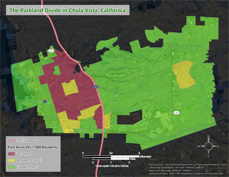
A new analysis shows how much Chula Vista residents’ access to parkland depends on where they live. The analysis, conducted by geographic information systems (GIS) researcher and Chula Vista resident Jacob Helfman, visualizes how areas east of Interstate 805 have over three times more parkland per person than those west of the freeway. Helfman’s analysis shows that many of the neighborhoods on the west side of the city with less parkland are also poorer, experience higher levels of pollution and are more likely to identify as Latino. The City Council’s decision this year to explore permanently closing Harborside Park in Southwest Chula Vista revived residents’ frustrations over that disparity and raised questions about how to bring more parks to the western half of the city.