As cornfields suffer crop damage caused by weather, corn producers can use geospatial and remote sensing technologies to get a more accurate measurement of the damage and estimate potential economic loss, according to a recent study published in Frontiers in Agronomy.
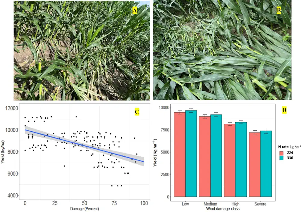
In the study, the United States Department of Agriculture’s (USDA), Agricultural Research Service (ARS) researchers from the Crop Production System Research Unit used a GPS-mounted yield monitoring system to assess green snap or “brittle snap”—a condition caused when corn stalks break from wind damage—in cornfields located in Stoneville, Mississippi, after severe winds affected the Delta region in May and June 2022. Researchers collected the yield maps from multiple cornfields and analyzed them to assess yield loss due to wind damage. Results indicated an average yield loss of approximately 26 pounds per acre per 1% of total wind damage.
The potential loss was estimated to vary from approximately $76 per acre for areas with less than 25% of wind damage to approximately $232 per acre for areas with more than 75% of wind damage. By getting accurate GPS coordinates of the damage locations and combining them with yield monitor data to estimate yield loss through geospatial technologies, producers can have a more reliable reference tool for assessing site-specific wind damage over large areas. “The research results could help predict potential yield loss and economic loss to assist producers and other stakeholders in decision-making to prepare for changing weather patterns and unprecedented severe windstorms in the future,” said Bhandari.