Consultant Card Geotechnics (CGL) has applied aerial laser surveying to pinpoint natural hazards on development sites across the UK. CGL is using geospatial data from aerial survey and geographic data company Bluesky. The data has formed part of the investigation stage on projects ranging from proposed residential developments to long, linear overhead powerlines.
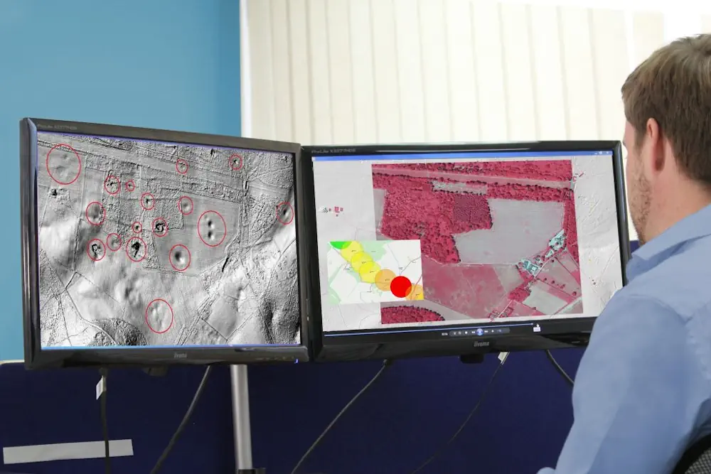
High-resolution aerial photography, specialist imagery and lidar terrain maps provided by Bluesky have been used to identify areas of high geological hazards and associated risks. These include sinkholes in chalk and other soluble rocks, saturated soft ground and peat deposits presenting compression hazards, and areas with slope instability and landslides. The data has helped CGL to provide an initial interpretive scan of a site to assess and target more intrusive surveys for additional investigation and detailed design. The consultancy has used the data, for example, in the identification of natural and anthropogenic hazards associated with chalk bedrock, which is highly susceptible to dissolution. It is widely found across northern, central and southern England.