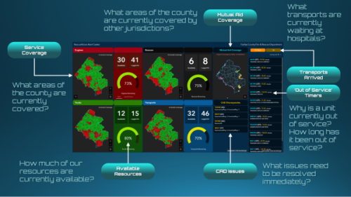
Our Fire and Rescue Department is constantly updating the ways it provides service to meet the needs of residents, including processing data that allows data-informed decisions about staffing and response. To meet these data goals, the department launched RescueVision to provide real-time situational awareness and decision support at the 911 dispatch center. RescueVision is a Geographical Information Systems (GIS)-driven application that provides immediate information on service coverage and resource availability, mutual aid, unit rosters and more.