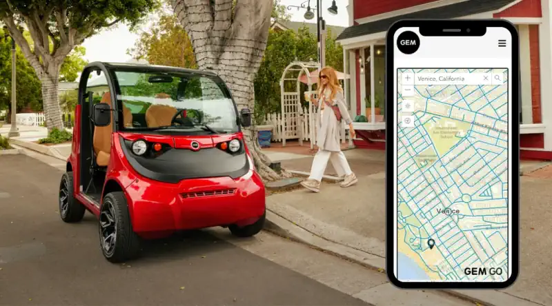
GEM has been producing low-speed electric vehicles for more than 25 years and has sold more than 65,000 of them. LSVs are more than a golf cart—they are street legal on most roads posted 35 mph or less. Yet knowing where those roads are and where a GEM can take you can be a challenge. In response, GEM has now created the first mapping tool for low-speed roads: GEM Go.
In partnership with Esri, and their ArcGIS Platform solution, the maps are updated quarterly with new data to help ensure the latest accuracy. More than half of United States roadways are assigned speed limits of 35 miles per hour or less, and that number is growing constantly as more cities are lowering speed limits to increase safe, healthy and equitable mobility. With GEM Go, users drop a pin or enter an address, and the map will populate with a radius of all roadways 35 mph or less. In cities such as Washington, DC, with a default speed limit of 20 mph, LSVs can get anywhere in the city and beyond.