In the maritime sector, work is ongoing towards the identification and development of alternative PNT (positioning, navigation and timing) solutions, that is, solutions that are not wholly dependent on GNSS-based technologies.
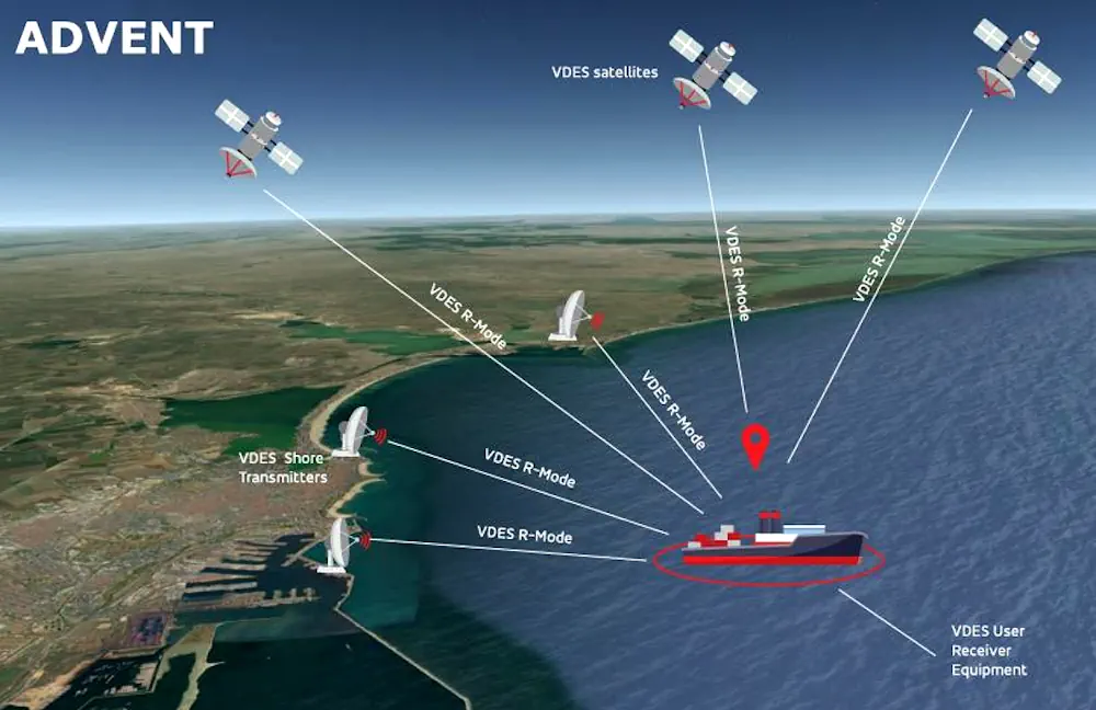
“The VHF data exchange system [VDES], is being considered as a source of alternative PNT [A-PNT] for maritime,” said Michael Turner of GMV NSL, “particularly through the use of its ranging capability, known as VDES-R. However, more research and demonstrations are needed to add to what we know about the potential of these technologies in maritime navigation.”
Turner was speaking at the recent final presentation of the ESA-funded ADVENT project, of which GMV NSL was lead partner. “We wanted to investigate the use of novel VDES technologies for enhancing key positioning performance figures,” he said, “such as accuracy, integrity and security, to compliment ongoing VDES investigations aimed at improving A-PNT capabilities for relevant maritime use cases.”
ADVENT partners, who included GMV NSL, GMV Innovating Solutions and UK-based RHEATECH, looked at the impact of key system capabilities, such as VDES-R synchronization and timing, while assessing both satellite-based (VDE-SAT) and terrestrial-based (VDE-TER) services.
The project developed a new VDES-R system simulator that can generate and process both VDE-TER and VDE-SAT signals, and it developed a proof-of-concept (PoC) testbed for terrestrial VDES-R, based on software defined radio (SDR).
The project also carried out a series of trials on the Black Sea, at Constanța, Romania, in October, 2023. “We deployed VDE-TER stations at designated locations,” said Turner, “and then transmitted VDES-R signals and received pseudoranges for positioning on the sea. We collected meaningful VDES data for post-processing.”
Among the results, the seagoing trials showed a 2D positioning accuracy of less than 50m, achieved using VDE-TER data in combination with VDE-SAT data and data from an inertial measurement unit (IMU). We previously reported on the results of another ESA-funded project, ICING, which demonstrated a positioning accuracy of about 1 km when using a single VDE-SAT ranging signal in the maritime setting.