The UK’s Peak District National Park Authority is pioneering the use of artificial intelligence (AI) to automate the production of highly detailed land cover maps, in a project in partnership with Cranfield University and The Alan Turing Institute.
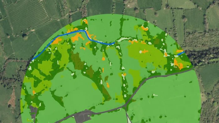
Land cover was classified from the Bluesky photography using Convolutional Neural Networks, a deep-learning AI method that excels in labelling natural photography. “Using this methodology, broad, high-level classes such as moorland, woodland or grasslands, were predicted with 95%accuracy, equivalent to human error rates. Then, in a second pass of the networks, low-level, detailed classes such as heather moor or deciduous woodland, were predicted with 72 to 92% accuracy,” added Thijs van der Plas, who worked with the Peak District via The Alan Turing Institute. “The AI predictions were merged with topographic maps from Ordnance Survey to create a complete land cover map of the Peak District.”