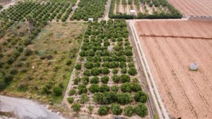
Quantify the abandonment of agricultural land using images from the Sentinel-2 satellite. This is the latest study completed by the Centre de Desenvolupament Rural de la Safor and will be presented in the coming weeks. A research included in the Copernicus program of the European Commission and that has allowed to evaluate the figures and detect the abandoned lands in order to create the first map of agricultural fields without cultivation in the region. It is a methodology based on satellite data and artificial intelligence techniques. These results open the doors to the annual monitoring of citrus crops and is presented as a key tool for the management of the abandonment of agricultural land. Precisely for this reason, which has become an increasingly big problem in Safor, and given the difficult situation that the sector is experiencing, this research has been promoted. From the CoR they have already advanced that the results obtained "are promising and will allow us to know the magnitude of the problem" in our region. The research has been funded by the Ministry for Ecological Transition.