A summer vacation changed Candela Sancho’s life. After studying physics in Madrid, getting additional training in Barcelona and Toronto and spending six years at the University of Utrecht, she traveled with friends to northern Italy in 2018. Upon returning home to Spain, she found out about the collapse on August 14 of the Ponte Morandi in Genoa, which they had crossed themselves just a few days before. Sancho wondered what had gone wrong to cause the collapse of a section of the viaduct, which killed 43 people.
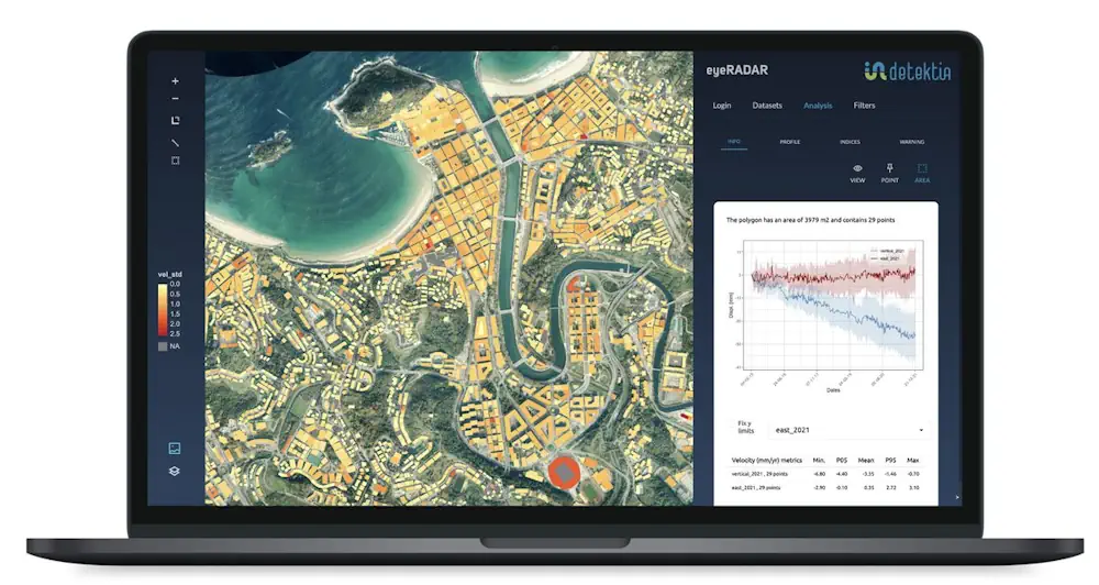
With their knowledge and some help from technology, she and her friends believed they could help prevent these types of accidents in the future. It was the seed of Detektia, a start-up that uses satellite sensors and proprietary technology to measure, down to the millimeter, how the ground and the buildings that sit on it deform over time. Last year they invoiced €70,000 ($73,800) and this year they plan to double that figure after going through several incubators and maturing their product. The basis for Detektia is satellite image technology, called InSAR, which measures the speed at which a surface or infrastructure moves.
The company has developed a technology to process this data based on machine learning and artificial intelligence, with which it produces situation reports, launches early warnings to avoid disasters such as Genoa, or make future predictions thanks to their own algorithms. Detektia is already working on projects in Spain, Colombia and Mexico in all phases of an infrastructure’s life: design, construction, operation and maintenance of infrastructure that includes dams, tunnels, embankments and ports.