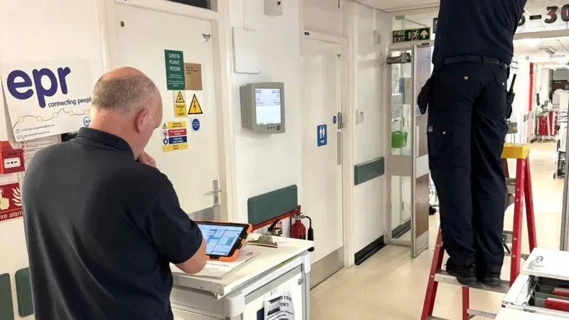
Hospital Using New Software To Manage Raac Repairs
A West Yorkshire hospital has become the first in the UK to use new geospatial software to help pinpoint high-risk crumbling concrete panels. More than 80% of floors, walls and ceilings at the Airedale Hospital, in Keighley, are made of Raac, or reinforced autoclaved aerated concrete, which has a lifespan of about 30 years. Though ...
bbc.com