Geomaticians

29

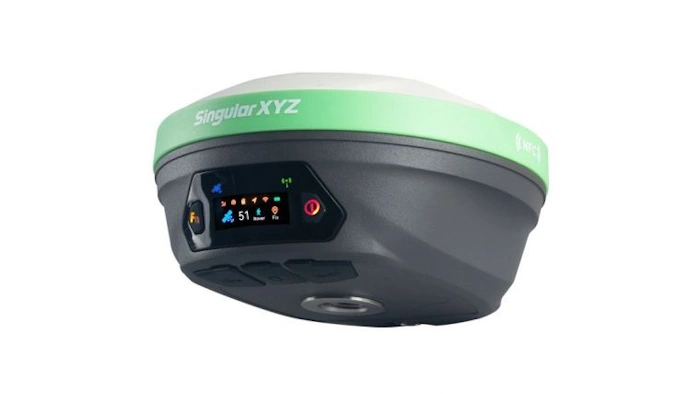
X1 Pro GNSS Receiver Enhances Surveying Precision

X1 Pro GNSS Receiver Enhances Surveying Precision

SingularXYZ has presented its latest innovation for geospatial professionals: the X1 Pro GNSS receiver. This new device aims to refine precision in surveying technology with a range of features tailored to streamline operations and improve accuracy. Central to the X1 Pro is its enhanced HD colour screen, providing users with clear visibility for monitoring status ...
gim-international.com

S. Korea, Japan To Cooperate In Developing Satellite Navigation System

South Korea and Japan will collaborate on the development and operation of regional satellite navigation systems in East Asia, Seoul’s science ministry said Tuesday. The two countries signed a memorandum of cooperation (MOC), designed for practical cooperation in developing and operating their respective satellite systems in the region, according to the Ministry of Science and ...
en.yna.co.kr

Geospatial Mapping And AI To Help Tackle Energy Gap In Africa

Energy modellers and researchers have developed a geospatial mapping model they say can help address the electricity access gap in Africa. The model has been developed by the International Energy Agency (IEA), researchers at Massachusetts Institute of Technology, University of Massachusetts Amherst and Electricity Growth and Use In Developing Economies. By mapping which buildings are ...
esi-africa.com

New PSGA Data Will Help Speed Up Emergency Response Times

A new selection of location datasets, including two new products, have been released today (Thursday 28 March) as part of the Public Sector Geospatial Agreement (PSGA). The new data and products have been delivered by Ordnance Survey (OS) and are set to support customers across a range of markets, including the emergency services, sustainability, land ...
gov.uk