Geomaticians

22

Dublin Urban Rivers Life Project Selects ESRI To Reduce Levels Of Wastewater

Geographic information systems (GIS) provider Esri Ireland has been chosed by Dublin Urban Rivers Life (DURL) project to help prevent preventing circa 13 million litres of polluted wastewater from entering Dublin rivers annually. DURL is a joint venture between South Dublin and Dún Laoghaire-Rathdown County Councils, with funding received from the EU Life Programme. It ...
techcentral.ie
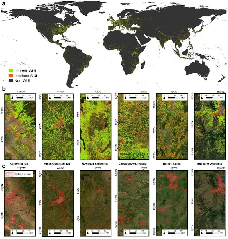
HKU Remote Sensing And Landscape Scholars Reveal Global Wildfire Risk Trends In Wildland-Urban Interface Areas (1985-2020)

HKU Remote Sensing And Landscape Scholars Reveal Global Wildfire Risk Trends In Wildland-Urban Interface Areas (1985-2020)

Wildfires present complex socio-economic and ecological challenges, as they devastate vegetation, endanger communities, and cause extensive environmental, wildlife, and human health impacts. These consequences include severe air pollution and soaring firefighting costs. Wildland-Urban Interface (WUI) areas, which are transition zones between wilderness and human-developed land, are particularly susceptible to wildfires. The risk is heightened due ...
eurekalert.org

Geospatial Commission-Funded Tool Demonstrates Potential For AI To Transform Decisions About Land Use

The Geospatial Commission, part of the Department for Science, Innovation and Technology (DSIT), has partnered with The Alan Turing Institute to explore the role that artificial intelligence (AI) can play in long-term decisions about how to use land. The UK is facing significant and competing pressures for its land. Advances in spatial data science and ...
gov.uk

Organic Farms Can Have Mixed Effects On Pesticide Use Depending On Their Neighbors

Organic agriculture may be as old as dirt, but that doesn’t mean its impacts are fully understood. A team of scientists in the United States and Canada are doing their part to change that. Researchers at UC Santa Barbara, University of British Columbia, and University of Colorado Boulder discovered that organic farming significantly affects the ...
news.ucsb.edu
Estimating Coastal Water Depth From Space Via Satellite-Derived Bathymetry

Estimating Coastal Water Depth From Space Via Satellite-Derived Bathymetry

With the development of shipborne echo sounders in the early 20th century, bathymetric surveys saw massive leaps in both accuracy and convenience. However, even with modern echo sounders, there are still many hardships to overcome when conducting bathymetric surveys. These include high cost, unpredictable weather, high ship traffic, and potential geographic or diplomatic issues, to ...
eurekalert.org